
Madhepura District: An Overview
Madhepura, is one of the 38th districts located in the northeastern part of Kosi—Seemanchal subregion of Mithila region, Bihar, India. The Madhepura district is part of the Kosi Division. Madhepura town is the district’s administrative headquarters. Known as the “land of simplicity and traditions”, Madhepura has historical connections to ancient Mithila and is an emerging industrial and educational hub in the region with a rich cultural heritage and agricultural significance.
Madhepura’s history begins during the Kushan Dynasty’s rule in ancient India. The Kushan Dynasty is the ancestor of the “Bhant community” people that reside in the Shankarpur block’s villages of Basantpur and Raibhir. The Mauryan pillar at Uda-kishunganj asserts that Madhepura was a part of the Maurya Dynasty at that time.
Gangapur, a settlement named for Gangadeo, the grandson of King Mithi, who is credited with founding the state of Mithila, is said to be the source of the name Madhepura. According to legend, the Sen Dynasty’s King Gangsen inspired the town of Gangapur’s name. With its many courses, the Kosi River continued to flow through the regions from Forbisganj to Chandeli Karamchand and Raghuvansha Nagar from 1704 to 1892 AD until emptying into the Ganges at Kursela. Since Madhepura is located in the middle of Kosi ravine, it was originally known as Madhyapura. Later, it was changed to Madhipura, which is now Madhepura.
Ancient Era
Since the majority of Lord Krishna‘s Madhava clan is claimed to have lived in the region, there is yet another opinion for its name. Madhavpur was the name given to it, and over time, Madhavpur evolved into Madhepura. (Taken from page 887 of Brihad Hindi Kosh, Fifth Edition).
Madhepura was still a part of Anga Desh in the past. The Mauryan, Shunga, Kanva, and Kushan empires also ruled it. During the Gupta Dynasty, it was a part of the province of Mithila. Evidence of this may be seen in the Mauryan Pillar that was found in Kishunganj. During Rajput dominion, Madhepura continued to be ruled by Bihar’s kings. A Bhar stronghold was the present-day Raibhir hamlet, which is part of the Singheshwar block.
Madhepura continued to be ruled by Sarkar Tirhut during the Mughal era. In Sarsandi village, which is under Uda-Kishunganj, there is still a mosque from Akbar’s reign. The coins found in Sahugarh village show that Sikander Sah had also been in the district. During British Raj, the Yadav Zamindars of Murho Estate, the largest landlords in the region, controlled the Madhepura area.
Key Facts About Madhepura District
- Country:
 India
India - State:
 Bihar
Bihar - Region: Mithila
- Division: Kosi
- Established: 9th May 1981
- Area: 1,787 km2 (690 sq mi)
- Population (2011):
- Total: 2,001,762
- Density: 1,100/km2 (2,900/sq mi)
- Literacy Rate: 53.78%
- Sex Ratio: 914
- District Headquarters: Madhepura
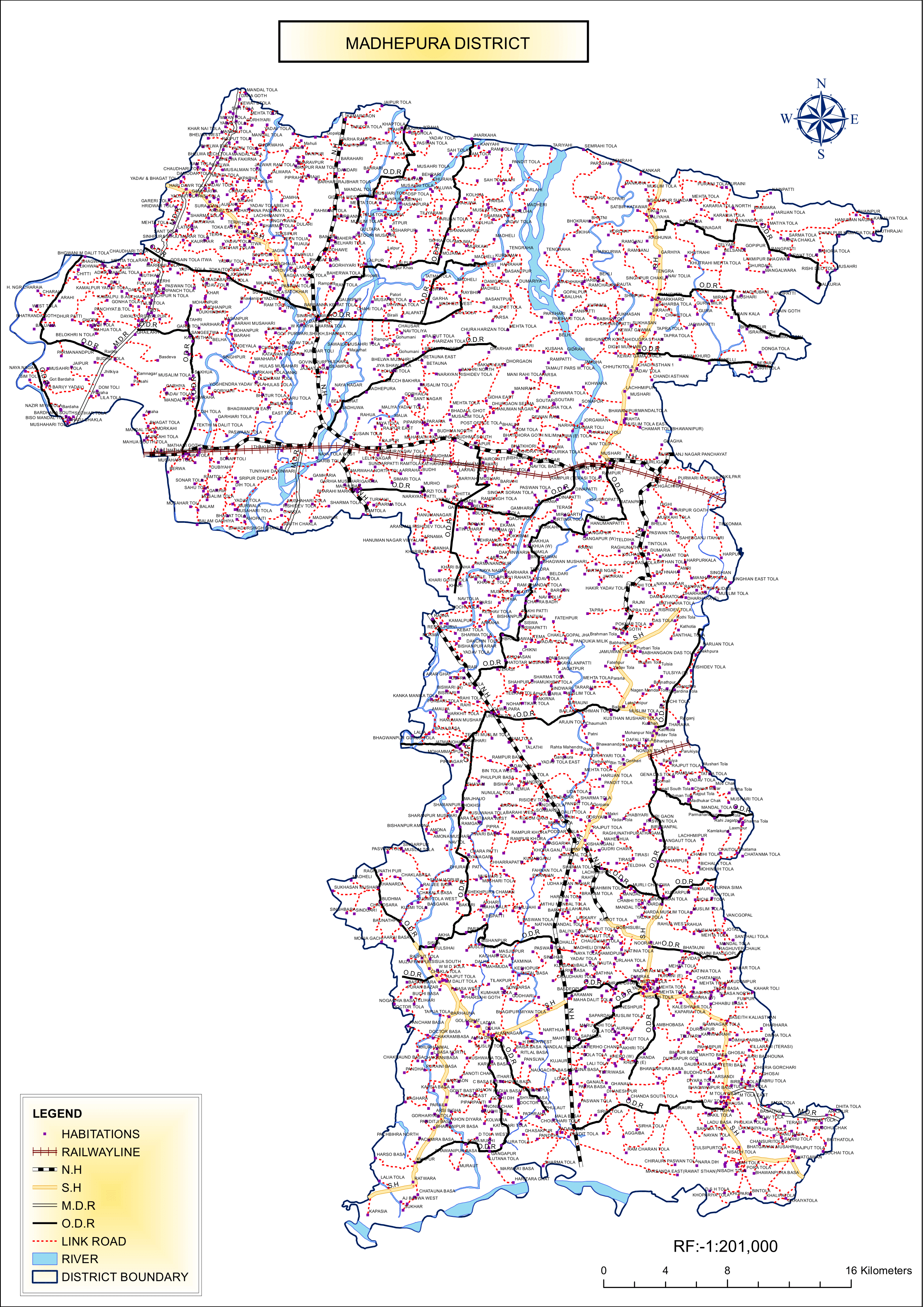
- Gram Panchayats: 170
- Villages: 449 (approx)
- No. of Subdivision: 2 (Madhepura, Udakishunganj)
- Police Station: 15
- MADHEPURA, SINGHESWAR, GAMHARIYA, SC/ST THANA, SHANKARPUR, MURLIGANJ, KUMARKHAND, SRINAGAR, MAHILA THANA, UDAKISHUNGANJ, CHAUSA, ALAMNAGAR, BIHARIGANJ, PURAINI, GWALPARA
- No. of Blocks: 13
- Madhepura, Singheshwar, Murliganj, Gamharia, Ghailar, Kumarkhand, Shankarpur, Chausa, Puraini, Gwalpara, Bihariganj, Uda kishunganj, Alamnagar
- Municipal Council(Nagar Parishad): 1 (Madhepura)
- Nagar Panchayat: 1 (Murliganj)
- Rivers: Koshi
- Lok Sabha constituency: 1 (Madhepura)
- Vidhan Sabha constituencies: 4 (Alamnagar, Bihariganj, Singheshwar, Madhepura)
- Key Features:
- Known for the Electric Locomotive Factory, a significant contributor to India’s railways.
- Primarily an agrarian district with fertile lands producing rice, sugarcane, and pulses.
- Historically connected to the freedom movement and Mithila culture.
- Significance: An emerging industrial district with agricultural roots.
- Notable person:
- Rash Bihari Lal Mandal, Zamindar of Murho Estate.
- Kamleshwari Prasad Yadav, Politician.
- B.P. Mandal, 7th Chief Minister of Bihar and chairman of the Second Backward Classes Commission (popularly known as the Mandal Commission).
- Time Zone: UTC+05:30 (IST)
- Coordinates: 25°54′36″N 86°46′48″E
- Major Highways: NH 106
- Official Website: madhepura.nic.in
Geography
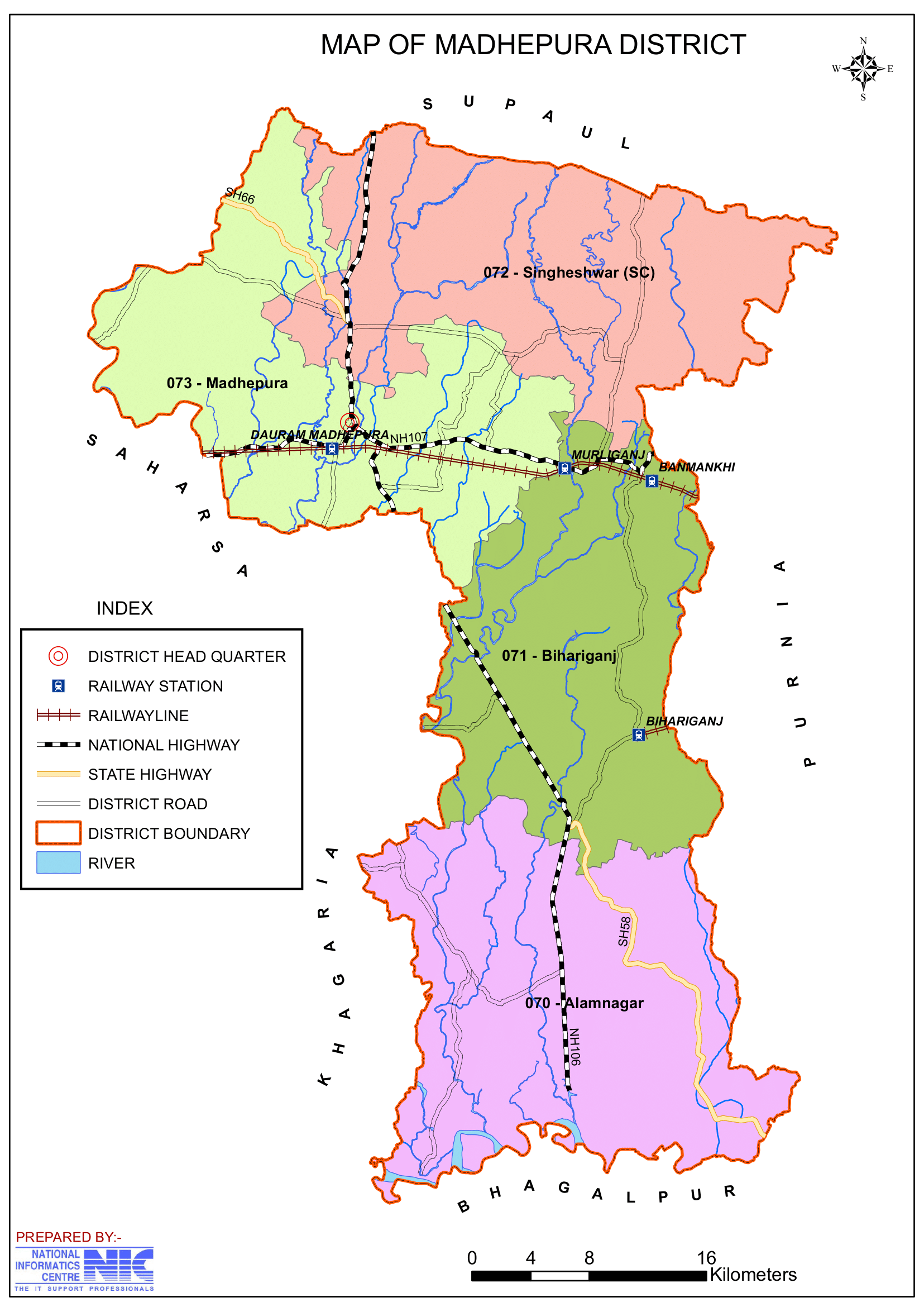
- Location: Madhepura district located in the northeastern region of Bihar at latitude between 25°. 34 to 26°.07′ and longitude between 86° .19′ to 87°.07′. It is bounded to the north by Araria and Supaul, to the south by Khagaria and Bhagalpur district, to the east by Purnia district, and to the west by Saharsa district.
- Area: The district covers an area of approximately 1,788 square kilometers.
- Rivers: The Kosi River, also known as the “Sorrow of Bihar”, flows through the district, contributing to the region’s agricultural fertility but also causing frequent floods.
- Climate: Madhepura district experiences a humid subtropical climate, with hot summers, heavy monsoons, and cool winters.
- Temperature Range:
- Maximum: 35 to 45 °C (95 to 113 °F).
- Minimum: 7 to 9 °C (45 to 48 °F).
- Rainfall:
- Madhepura district receives an average annual rainfall of 1,300 mm (51 inches).
- Temperature Range:
History
- Ancient Era: The region has historical ties to the Mithila kingdom and finds mention in ancient Indian texts and folklore. It is an integral part of the cultural and historical landscape of Mithila.
- Medieval Period: During the medieval era, the region was known for its traditional Maithili culture and scholarly pursuits.
- Modern History:
- Madhepura district was carved out of Saharsa district on 9 May 1981 to become an independent administrative unit.
- Before then, on September 3, 1845, Madhepura became a subdivision of Bhagalpur district. Saharsa district was divided into three subdivisions on April 1, 1954: Saharsa, Madhepura, and Supaul of Bhagalpur district. Previously located in Kishanganj, the Munsif court was founded at Madhepura in 1865. In 1944, the Sub Judge Court was founded here.
Demographics
- Population:
- Total: According to the 2011 Census, Madhepura district has a population of 2,001,762 (approximately 2 million), comparable to the population of Republic of Slovenia, a country in Central Europe.
- Ranking: 232nd in India (out of 640 districts).
- Population Density: 1,116 inhabitants per square kilometre (2,890/sq mi).
- Growth Rate (2001–2011): 30.65%, reflecting significant population increase.
- Urban Population: 4.42%
- Literacy Rate: According to the 2011 Census, the literacy rate is around 53.78%, with significant efforts needed to improve education, particularly in rural areas.
- Sex Ratio: 914 females per 1,000 males, indicating a gender disparity.
- Religious Composition (2011 Census):
- Hinduism: 87.61%
- Yadav caste: 25%
- Scheduled Castes: 17.30%
- Scheduled Tribes: 0.63%
- Islam: 12.08%
- Other or not stated: 0.31%
- Hinduism: 87.61%
- Languages: The primary language spoken is Maithili, followed by Hindi, Urdu and Santali.
- Maithili: 38.43%
- Hindi: 37.15%
- ‘Other’ Hindi: 18.04%
- Urdu: 5.71%
- Santali: 0.40%
- Others: 0.27%
Administration
- Headquarters: Madhepura town serves as the district headquarters.
- Subdivisions:
- The district is divided into two subdivisions: Madhepura and Uda Kishunganj, which are further subdivided into blocks.
- Each subdivision is led by a subdivisional magistrate who is in charge of development, revenue-related tasks, and maintaining law and order.
- Blocks and Circles:
- Saharsa district is divided into 13 Blocks and Circles such as Madhepura, Singheshwar, Murliganj, Gamharia, Ghailar, Kumarkhand, Shankarpur, Chausa, Puraini, Gwalpara, Bihariganj, Uda kishunganj and Alamnagar.
- A circle officer (CO) leads each circle, while a Block Development Officer (BDO) leads each block.
- Governance: Madhepura is part of the Kosi division and has representation in both the Bihar Legislative Assembly and the Indian Parliament.
- Governmental institutions and courts include:
- Municipal Corporation
- Collectorate
- Office of the Divisional Commissioner
- District Court, Madhepura
- Urban Improvement Trust (UIT)
- Health services: Healthcare is offered by a mix of governmental and private hospitals, include:
- Sadar Hospital, Madhepura
- Madhipura Christian Hospital
Organisation Chart

Economy
- Backward District Recognition (2006):
- Identified as one of India’s 250 most backward districts (out of a total of 640) by the Ministry of Panchayati Raj.
- Reflects socio-economic challenges and developmental lag.
- Developmental Funding:
- Included among the 36 districts in Bihar receiving financial aid under the Backward Regions Grant Fund Programme (BRGF).
- Aims to support infrastructure development, enhance rural livelihoods, and reduce regional disparities.
- Agriculture:
- The economy is primarily agrarian, with major crops including rice, wheat, maize, pulses, and oilseeds. The fertile alluvial soil and irrigation from the Kosi River support high agricultural productivity.
- Challenges: It has seen a number of ups and downs brought on by Kosi, including drought, hunger, and floods. Drought and flooding have continued to be frequent occurrences in the region.
- Industries:
- Railway Factory:
- Madhepura houses a railway electric locomotive factory, a significant industrial project by Indian Railways and Alstom (France), making it an emerging industrial hub.
- Notable for manufacturing WAG-12, India’s most powerful railway engine.
- Symbolizes a major industrial advancement and employment opportunity in the region.
- Small-scale Industries: The district has small-scale industries related to agro-products, textiles, and handicrafts.
- Railway Factory:
- Trade: Madhepura serves as a local trading center for agricultural and consumer goods.
Education
Madhepura district has 834 government schools that educate students, and has a growing educational infrastructure with schools, colleges, and universities:
- Bhupendra Narayan Mandal University (BNMU): A prominent university is situated at the district headquarter in the region offering undergraduate and postgraduate programs in various disciplines and enhances the district’s educational environment.
- Schools and Colleges: Several government and private institutions cater to the educational needs of the district.
- Technical Education: Initiatives are underway to establish more technical and vocational training centers to enhance employment opportunities.
- List of educational institutes:
- P.Sc. College.
- H S College, Udakishunganj
- L N College, Bangow
- R P M College, Tuniyahi
- Thakur Prasad College, Madhepura
- SAMIDHA GROUP
- Keshav Kanya High School
- Shiv Nandan Prasad Mandal High School
- Jawahar Navodaya Vidyalaya.
- Kiran Public School, Holy Cross, Holy angels.
- B R Oxford Residential Public School, Murliganj Madhepura.
- DeiGratia International School, Tuniyahi Uttarwari, Madhepura, Bihar.
Culture
- Festivals: Traditional festivals like Chhath Puja, Durga Puja, and Makar Sankranti are celebrated with great enthusiasm. Local fairs and religious gatherings also play a significant role in community life.
- Cuisine: The district’s cuisine reflects Maithili culture, with popular dishes like litti chokha, dal-pitha, ghughni, and sweets like tilkut and khaja.
- Art and Music: Madhepura shares the rich Maithili tradition of music, folk dances, and art, including Maithili paintings.
Tourism
Madhepura offers a few places of cultural, historical, and natural significance:
- Durga Sthan Temple:
- Location: Situated 11 km from Gwalpara Block Headquarters and 35 km from Madhepura District Headquarters.
- Religious Importance:
- Renowned for Manokamna Siddhi (fulfillment of wishes), not just in Madhepura but also in the surrounding areas.
- Devotees visit to seek blessings and offer prayers to Goddess Durga for the realization of their wishes.
- Offerings and Beliefs:
- Devotees present floral offerings and Bipatra (bel leaves) to Goddess Durga.
- A popular belief holds that wishes are fulfilled if the offerings are accepted by the deity.
- Singheshwar Temple:
- Location: Singheshwar Asthan is located 8 km from Dauram Madhepura (N.E Railway) and serves as the headquarters of the block bearing the same name.
- Religious Significance:
- Known for an ancient Shiva temple, it is believed that Sringa Rishi established the Shiva lingam here.
- The temple has strong ties to the legend of Sringa Rishi, who performed the Putrayeshti Yajna for King Dasharath, resulting in the birth of his four sons.
- Spiritual Attraction: The temple is a destination for barren women who come to offer prayers, seeking blessings for children.
- Shivaratri Fair: A month-long fair is held annually on the occasion of Shivaratri, making it one of the largest fairs in the state and drawing numerous devotees.
- Location: Singheshwar Asthan is located 8 km from Dauram Madhepura (N.E Railway) and serves as the headquarters of the block bearing the same name.
- Dakini Sthan: Situated 5 km from Alamnagar Block Headquarters and 60 km from Madhepura District Headquarters. A place of religious and cultural importance in the region.
- Kosi River: While it poses challenges, the river’s scenic beauty and role in agriculture make it a prominent feature of the district.
Transportation
- Railways: Madhepura has good railway connectivity, with the Madhepura Junction serving as a hub for passenger and goods trains. It connects the district to major cities in Bihar and beyond.
- Roadways: The district is connected by National and State Highways, with regular bus services linking it to nearby towns and cities.
- Nearest Airport: The nearest airports are Darbhanga Airport (approximately 125 km) and Patna Airport (approximately 250 km).
Challenges
- Flooding: The Kosi River’s frequent floods cause significant damage to life, property, and agriculture, making flood management a major challenge.
- Infrastructure: Limited infrastructure in healthcare, education, and transportation, particularly in rural areas, hampers development.
- Unemployment: The lack of large-scale industries results in migration to other states for better job opportunities.
Conclusion
Madhepura is a district with immense potential, characterized by its agricultural strength, cultural heritage, and emerging industrial development. Despite challenges like floods and infrastructure gaps, the district is making strides in education and industrialization. With proper investment in flood control, infrastructure, and education, Madhepura has the potential to become a significant economic and cultural hub in Bihar.
Would you like more details about any specific Topics on Bihar? Comment Below or checkout these topics
मधेपुरा जिला: इसके विशेष आकर्षण और यात्रा की खोज करें
अवलोकन
मधेपुरा, भारत के बिहार राज्य के मिथिला क्षेत्र के कोसी-सीमांचल उपक्षेत्र के उत्तर-पूर्वी भाग में स्थित 38वें जिलों में से एक है। मधेपुरा जिला कोसी डिवीजन का हिस्सा है। मधेपुरा शहर जिले का प्रशासनिक मुख्यालय है। “सादगी और परंपराओं की भूमि” के रूप में जाना जाने वाला मधेपुरा का प्राचीन मिथिला से ऐतिहासिक संबंध है और यह समृद्ध सांस्कृतिक विरासत और कृषि महत्व के साथ इस क्षेत्र में एक उभरता हुआ औद्योगिक और शैक्षिक केंद्र है।
मधेपुरा का इतिहास प्राचीन भारत में कुषाण राजवंश के शासन के दौरान शुरू होता है। कुषाण राजवंश “भंट समुदाय” के लोगों का पूर्वज है जो शंकरपुर ब्लॉक के बसंतपुर और रायभीर गांवों में रहते हैं। उदा-किशुनगंज में मौर्य स्तंभ यह दावा करता है कि मधेपुरा उस समय मौर्य राजवंश का हिस्सा था।
गंगापुर, राजा मिथि के पोते गंगादेव के नाम पर बसा एक शहर है, जिन्हें मिथिला राज्य की स्थापना का श्रेय दिया जाता है, इसे मधेपुरा नाम का स्रोत माना जाता है। किंवदंती के अनुसार, सेन राजवंश के राजा गंगसेन ने गंगापुर शहर के नाम को प्रेरित किया। अपने कई मार्गों के साथ, कोसी नदी 1704 से 1892 ई. तक फ़ॉरबिसगंज से चंदेली करमचंद और रघुवंश नगर के क्षेत्रों से होकर बहती रही, जब तक कि यह कुरसेला में गंगा में समा नहीं गई। चूँकि मधेपुरा कोसी घाटी के बीच में स्थित है, इसलिए इसे मूल रूप से मध्यपुरा के नाम से जाना जाता था। बाद में, इसे बदलकर मधिपुरा कर दिया गया, जो अब मधेपुरा है।
प्राचीन युग का दावा
चूँकि भगवान कृष्ण के माधव वंश के अधिकांश लोग इस क्षेत्र में रहते थे, इसलिए इसके नाम के लिए एक और राय है। इसे माधवपुर नाम दिया गया था, और समय के साथ, माधवपुर मधेपुरा में विकसित हुआ। (बृहद हिंदी कोष, पाँचवाँ संस्करण के पृष्ठ 887 से लिया गया)। मधेपुरा अतीत में भी अंग देश का हिस्सा था। मौर्य, शुंग, कण्व और कुषाण साम्राज्यों ने भी इस पर शासन किया। गुप्त वंश के दौरान, यह मिथिला प्रांत का हिस्सा था। इसका प्रमाण किशुनगंज में पाए गए मौर्य स्तंभ में देखा जा सकता है। राजपूत शासन के दौरान, मधेपुरा पर बिहार के राजाओं का शासन रहा। एक भर गढ़ वर्तमान में रायभीर टोला था, जो सिंहेश्वर ब्लॉक का हिस्सा है।
मुगल काल के दौरान मधेपुरा पर सरकार तिरहुत का शासन रहा। उदा-किशुनगंज के अंतर्गत आने वाले सरसंडी गांव में आज भी अकबर के शासनकाल की एक मस्जिद है। साहूगढ़ गांव में मिले सिक्कों से पता चलता है कि सिकंदर साह भी जिले में थे। ब्रिटिश राज के दौरान, मुरहो एस्टेट के यादव जमींदार, जो इस क्षेत्र के सबसे बड़े जमींदार थे, मधेपुरा क्षेत्र को नियंत्रित करते थे।
मधेपुरा जिले के बारे में मुख्य तथ्य
- देश: भारत
- राज्य: बिहार
- क्षेत्र: मिथिला
- प्रमंडल: कोसी
- स्थापना: 9 मई 1981
- क्षेत्रफल: 1,787 km2 (690 वर्ग मील)
- जनसंख्या (2011):
- कुल: 2,001,762
- घनत्व: 1,100/km2 (2,900/वर्ग मील)
- साक्षरता दर: 53.78%
- लिंगानुपात: 914
- जिला मुख्यालय: मधेपुरा
- ग्राम पंचायतें: 170
- गाँव: 449 (लगभग)
- अनुमण्डल की संख्या: 2 (मधेपुरा, उदाकिशुनगंज)
- पुलिस स्टेशन: 15
- मधेपुरा, सिंहेश्वर, गम्हरिया, एससी/एसटी थाना, शंकरपुर, मुरलीगंज, कुमारखंड, श्रीनगर, महिला थाना, उदाकिशुनगंज, चौसा, आलमनगर, बिहारीगंज, पुरैनी, ग्वालपाड़ा
- ब्लॉकों की संख्या: 13
- मधेपुरा, सिंहेश्वर, मुरलीगंज, गम्हरिया, घैलार, कुमारखंड, शंकरपुर, चौसा, पुरैनी, ग्वालपाड़ा, बिहारीगंज, उदा किशुनगंज, आलमनगर
- नगर परिषद: 1 (मधेपुरा)
- नगर पंचायत: 1 (मुरलीगंज)
- नदियाँ: कोशी
- लोकसभा क्षेत्र: 1 (मधेपुरा)
- विधानसभा क्षेत्र: 4 (आलमनगर, बिहारीगंज, सिंहेश्वर, मधेपुरा)
- प्रमुख विशेषताऐं:
- इलेक्ट्रिक लोकोमोटिव के लिए जाना जाता है फैक्ट्री, भारत के रेलवे में महत्वपूर्ण योगदानकर्ता।
- मुख्य रूप से एक कृषि प्रधान जिला, जिसकी उपजाऊ भूमि चावल, गन्ना और दालें पैदा करती है।
- ऐतिहासिक रूप से स्वतंत्रता आंदोलन और मिथिला संस्कृति से जुड़ा हुआ है।
- महत्व: कृषि जड़ों वाला एक उभरता हुआ औद्योगिक जिला।
- उल्लेखनीय व्यक्ति:
- रास बिहारी लाल मंडल, मुरहो एस्टेट के ज़मींदार।
- कमलेश्वरी प्रसाद यादव, राजनीतिज्ञ।
- बी.पी. मंडल, बिहार के 7वें मुख्यमंत्री और दूसरे पिछड़ा वर्ग आयोग (जिसे मंडल आयोग के नाम से जाना जाता है) के अध्यक्ष।
- समय क्षेत्र: UTC+05:30 (IST)
- निर्देशांक: 25°54′36″N 86°46′48″E
- प्रमुख राजमार्ग: NH 106
- आधिकारिक वेबसाइट: madhepura.nic.in
भूगोल
- स्थान: मधेपुरा जिला बिहार के पूर्वोत्तर क्षेत्र में 25°.34 से 26°.07′ अक्षांश और 86°.19′ से 87°.07′ देशांतर पर स्थित है। यह उत्तर में अररिया और सुपौल, दक्षिण में खगड़िया और भागलपुर जिले, पूर्व में पूर्णिया जिले और पश्चिम में सहरसा जिले से घिरा हुआ है।
- क्षेत्र: जिले का क्षेत्रफल लगभग 1,788 वर्ग किलोमीटर है।
- नदियाँ: कोसी नदी, जिसे “बिहार का शोक” भी कहा जाता है, जिले से होकर बहती है, जो क्षेत्र की कृषि उर्वरता में योगदान देती है, लेकिन अक्सर बाढ़ का कारण भी बनती है।
- जलवायु: जिले में गर्म ग्रीष्मकाल, भारी मानसून और ठंडी सर्दियाँ के साथ आर्द्र उपोष्णकटिबंधीय जलवायु का अनुभव होता है।
- तापमान सीमा:
- अधिकतम: 35 से 45 °C (95 से 113 °F)
- न्यूनतम: 7 से 9 °C (45 से 48 °F)
- वर्षा:
- जिले में औसतन 1,300 mm (51 इंच) वार्षिक वर्षा होती है।
- तापमान सीमा:
इतिहास
- प्राचीन युग: इस क्षेत्र का मिथिला साम्राज्य से ऐतिहासिक संबंध है और इसका उल्लेख प्राचीन भारतीय ग्रंथों और लोककथाओं में मिलता है। यह मिथिला के सांस्कृतिक और ऐतिहासिक परिदृश्य का एक अभिन्न अंग है।
- मध्यकालीन काल: मध्यकालीन युग के दौरान, यह क्षेत्र अपनी पारंपरिक मैथिली संस्कृति और विद्वत्तापूर्ण गतिविधियों के लिए जाना जाता था।
- आधुनिक इतिहास:
- 9 मई 1981 को मधेपुरा को सहरसा जिले से अलग करके एक स्वतंत्र प्रशासनिक इकाई बनाया गया।
- इससे पहले, 3 सितंबर, 1845 को मधेपुरा भागलपुर जिले का एक उपखंड बन गया था। सहरसा जिले को 1 अप्रैल, 1954 को तीन उपखंडों में विभाजित किया गया: भागलपुर जिले के सहरसा, मधेपुरा और सुपौल। पहले किशनगंज में स्थित, मुंसिफ न्यायालय की स्थापना 1865 में मधेपुरा में की गई थी। 1944 में, यहाँ उप न्यायाधीश न्यायालय की स्थापना की गई थी।
जनसांख्यिकी
- जनसंख्या:
- कुल: 2011 की जनगणना के अनुसार, मधेपुरा की जनसंख्या 2,001,762 (लगभग 2 मिलियन) है, जो मध्य यूरोप के एक देश, स्लोवेनिया गणराज्य की जनसंख्या के बराबर है।
- रैंकिंग: भारत में 232वाँ (640 जिलों में से)।
- जनसंख्या घनत्व: 1,116 निवासी प्रति वर्ग किलोमीटर (2,890/वर्ग मील)।
- वृद्धि दर (2001-2011): 30.65%, जो महत्वपूर्ण जनसंख्या वृद्धि को दर्शाता है।
- शहरी जनसंख्या: 4.42%
- साक्षरता दर: 2011 की जनगणना के अनुसार, साक्षरता दर लगभग 53.78% है, जिसमें शिक्षा में सुधार के लिए महत्वपूर्ण प्रयासों की आवश्यकता है, विशेष रूप से ग्रामीण क्षेत्रों में।
- लिंग अनुपात: 1,000 पुरुषों पर 914 महिलाएं, जो लैंगिक असमानता को दर्शाता है।
- धार्मिक संरचना (2011 की जनगणना):
- हिंदू धर्म: 87.61%
- यादव जाति: 25%
- अनुसूचित जाति: 17.30%
- अनुसूचित जनजाति: 0.63%
- इस्लाम: 12.08%
- अन्य या नहीं बताया गया: 0.31%
- हिंदू धर्म: 87.61%
- भाषाएँ: बोली जाने वाली मुख्य भाषा मैथिली है, उसके बाद हिंदी, उर्दू और संथाली हैं।
- मैथिली: 38.43%
- हिंदी: 37.15%
- ‘अन्य’ हिंदी: 18.04%
- उर्दू: 5.71%
- संथाली: 0.40%
- अन्य: 0.27%
प्रशासन
- मुख्यालय: मधेपुरा शहर जिला मुख्यालय के रूप में कार्य करता है।
- उपखंड:
- जिले को दो उपखंडों में विभाजित किया गया है: मधेपुरा और उदा किशुनगंज, जिन्हें आगे ब्लॉकों में विभाजित किया गया है।
- प्रत्येक उपविभाग का नेतृत्व एक उपविभागीय मजिस्ट्रेट द्वारा किया जाता है जो विकास, राजस्व संबंधी कार्यों और कानून एवं व्यवस्था बनाए रखने का प्रभारी होता है।
- ब्लॉक और सर्कल:
- सहरसा जिले को मधेपुरा, सिंहेश्वर, मुरलीगंज, गम्हरिया, घैलार, कुमारखंड, शंकरपुर, चौसा, पुरैनी, ग्वालपारा, बिहारीगंज, उदा किशुनगंज और आलमनगर जैसे 13 ब्लॉक और सर्कल में बांटा गया है।
- प्रत्येक सर्कल का नेतृत्व एक सर्कल अधिकारी (सीओ) करता है, जबकि प्रत्येक ब्लॉक का नेतृत्व एक खंड विकास अधिकारी (बीडीओ) करता है।
- शासन: मधेपुरा कोसी डिवीजन का हिस्सा है और बिहार विधान सभा और भारतीय संसद दोनों में इसका प्रतिनिधित्व है।
- सरकारी संस्थानों और न्यायालयों में शामिल हैं:
- नगर निगम
- कलेक्ट्रेट
- मंडल आयुक्त का कार्यालय
- जिला न्यायालय, मधेपुरा
- शहरी सुधार ट्रस्ट (यूआईटी)
- स्वास्थ्य सेवाएँ: स्वास्थ्य सेवा सरकारी और निजी अस्पतालों के मिश्रण द्वारा प्रदान की जाती है, जिनमें शामिल हैं:
- सदर अस्पताल, मधेपुरा
- मधेपुरा क्रिश्चियन अस्पताल
अर्थव्यवस्था
- पिछड़ा जिला मान्यता (2006):
- पंचायती राज मंत्रालय द्वारा भारत के 250 सबसे पिछड़े जिलों (कुल 640 में से) में से एक के रूप में पहचाना गया।
- सामाजिक-आर्थिक चुनौतियों और विकासात्मक पिछड़ेपन को दर्शाता है।
- विकासात्मक निधि:
- विकासात्मक निधि प्राप्त करने वाले बिहार के 36 जिलों में शामिल पिछड़ा क्षेत्र अनुदान निधि कार्यक्रम (BRGF) के तहत वित्तीय सहायता।
- इसका उद्देश्य बुनियादी ढांचे के विकास का समर्थन करना, ग्रामीण आजीविका को बढ़ाना और क्षेत्रीय असमानताओं को कम करना है।
- कृषि:
- अर्थव्यवस्था मुख्य रूप से कृषि आधारित है, जिसमें चावल, गेहूं, मक्का, दालें और तिलहन जैसी प्रमुख फसलें शामिल हैं। उपजाऊ जलोढ़ मिट्टी और कोसी नदी से सिंचाई उच्च कृषि उत्पादकता का समर्थन करती है।
- चुनौतियाँ: इसने कई उतार-चढ़ाव देखे हैं कोसी नदी के कारण सूखा, भुखमरी और बाढ़ जैसी आपदाएँ आती रहती हैं। इस क्षेत्र में सूखा और बाढ़ की घटनाएँ लगातार होती रहती हैं।
- उद्योग:
- रेलवे कारखाना:
- मधेपुरा में रेलवे इलेक्ट्रिक लोकोमोटिव कारखाना है, जो भारतीय रेलवे और एल्सटॉम (फ्रांस) द्वारा एक महत्वपूर्ण औद्योगिक परियोजना है। , जो इसे एक उभरता हुआ औद्योगिक केंद्र बनाता है।
- भारत के सबसे शक्तिशाली रेलवे इंजन WAG-12 के निर्माण के लिए उल्लेखनीय है।
- क्षेत्र में एक प्रमुख औद्योगिक उन्नति और रोजगार के अवसर का प्रतीक है।
- लघु उद्योग: जिले में कृषि उत्पादों से संबंधित लघु उद्योग हैं , वस्त्र और हस्तशिल्प।
- रेलवे कारखाना:
- व्यापार: मधेपुरा कृषि और उपभोक्ता वस्तुओं के लिए एक स्थानीय व्यापार केंद्र के रूप में कार्य करता है।
शिक्षा
मधेपुरा जिले में 834 सरकारी स्कूल हैं जो छात्रों को शिक्षा देते हैं, और स्कूलों, कॉलेजों और विश्वविद्यालयों के साथ शैक्षिक बुनियादी ढाँचा बढ़ रहा है:
- भूपेंद्र नारायण मंडल विश्वविद्यालय (BNMU): इस क्षेत्र में जिला मुख्यालय पर एक प्रमुख विश्वविद्यालय स्थित है जो विभिन्न विषयों में स्नातक और स्नातकोत्तर कार्यक्रम प्रदान करता है और जिले के शैक्षिक वातावरण को बढ़ाता है।
- स्कूल और कॉलेज: कई सरकारी और निजी संस्थान जिले की शैक्षिक आवश्यकताओं को पूरा करते हैं।
- तकनीकी शिक्षा: रोज़गार के अवसरों को बढ़ाने के लिए अधिक तकनीकी और व्यावसायिक प्रशिक्षण केंद्र स्थापित करने की पहल चल रही है।
- शैक्षणिक संस्थानों की सूची:
- P.Sc. कॉलेज।
- एचएस कॉलेज, उदाकिशुनगंज
- एल एन कॉलेज, बंगो
- आरपीएम कॉलेज, तुनियाही
- ठाकुर प्रसाद कॉलेज, मधेपुरा
- समिधा ग्रुप
- केशव कन्या हाई स्कूल
- शिव नंदन प्रसाद मंडल हाई स्कूल
- जवाहर नवोदय विद्यालय।
- किरण पब्लिक स्कूल, होली क्रॉस, होली एंजल्स।
- बी आर ऑक्सफोर्ड रेसिडेंशियल पब्लिक स्कूल, मुरलीगंज मधेपुरा।
- डेग्रेटिया इंटरनेशनल स्कूल, तुनियाही उत्तरवारी, मधेपुरा, बिहार।
संस्कृति
- त्यौहार: छठ पूजा, दुर्गा पूजा और मकर संक्रांति जैसे पारंपरिक त्यौहार बड़े उत्साह के साथ मनाए जाते हैं। स्थानीय मेले और धार्मिक समारोह भी सामुदायिक जीवन में महत्वपूर्ण भूमिका निभाते हैं।
- भोजन: जिले का भोजन मैथिली संस्कृति को दर्शाता है, जिसमें लिट्टी चोखा, दाल-पीठा, घुघनी जैसे लोकप्रिय व्यंजन और तिलकुट और खाजा जैसी मिठाइयाँ शामिल हैं।
- कला और संगीत: मधेपुरा में संगीत, लोक नृत्य और मैथिली चित्रकला सहित कला की समृद्ध मैथिली परंपरा है।
पर्यटन
मधेपुरा में सांस्कृतिक, ऐतिहासिक और प्राकृतिक महत्व के कुछ स्थान हैं:
- दुर्गा स्थान मंदिर:
- स्थान: ग्वालपाड़ा ब्लॉक मुख्यालय से 11 किमी और मधेपुरा जिला मुख्यालय से 35 किमी दूर स्थित है।
- धार्मिक महत्व:
- यह मंदिर न केवल मधेपुरा में बल्कि आस-पास के इलाकों में भी मनोकामना सिद्धि (इच्छाओं की पूर्ति) के लिए प्रसिद्ध है।
- भक्तजन अपनी इच्छाओं की पूर्ति के लिए देवी दुर्गा से आशीर्वाद लेने और प्रार्थना करने आते हैं।
- प्रसाद और मान्यताएँ:
- भक्तगण देवी दुर्गा को पुष्प और बिपत्र (बेल के पत्ते) चढ़ाते हैं।
- एक लोकप्रिय मान्यता है कि अगर देवी द्वारा चढ़ाए गए प्रसाद को स्वीकार कर लिया जाए तो मनोकामनाएँ पूरी होती हैं।
- सिंहेश्वर मंदिर:
- स्थान: सिंहेश्वर स्थान, दौराम मधेपुरा (उत्तर पूर्व रेलवे) से 8 किमी दूर स्थित है और इसी नाम वाले ब्लॉक का मुख्यालय है।
- धार्मिक महत्व:
- यह एक प्राचीन शिव मंदिर के लिए जाना जाता है, ऐसा माना जाता है कि श्रृंग ऋषि ने यहाँ शिवलिंग की स्थापना की थी।
- इस मंदिर का श्रृंग ऋषि की किंवदंती से गहरा संबंध है, जिन्होंने राजा दशरथ के लिए पुत्रयेष्टि यज्ञ किया था, जिसके परिणामस्वरूप उनके चार पुत्रों का जन्म हुआ था।
- आध्यात्मिक आकर्षण: यह मंदिर बांझ महिलाओं के लिए एक गंतव्य है जो बच्चों के लिए आशीर्वाद मांगने के लिए प्रार्थना करने आती हैं।
- शिवरात्रि मेला: शिवरात्रि के अवसर पर हर साल एक महीने तक चलने वाला मेला लगता है, जो इसे राज्य के सबसे बड़े मेलों में से एक बनाता है और बड़ी संख्या में भक्तों को आकर्षित करता है।
- डाकिनी स्थान: आलमनगर ब्लॉक मुख्यालय से 5 किमी और मधेपुरा जिला मुख्यालय से 60 किमी दूर स्थित है। इस क्षेत्र में धार्मिक और सांस्कृतिक महत्व का स्थान है।
- कोसी नदी: हालांकि यह चुनौतियां पेश करती है, लेकिन नदी की प्राकृतिक सुंदरता और कृषि में भूमिका इसे जिले की एक प्रमुख विशेषता बनाती है।
परिवहन
- रेलवे: मधेपुरा में रेलवे की अच्छी कनेक्टिविटी है, मधेपुरा जंक्शन यात्री और मालगाड़ियों के लिए हब के रूप में काम करता है। यह जिले को बिहार और उसके बाहर के प्रमुख शहरों से जोड़ता है।
- सड़क मार्ग: जिला राष्ट्रीय और राज्य राजमार्गों से जुड़ा हुआ है, नियमित बस सेवाएँ इसे आस-पास के शहरों और कस्बों से जोड़ती हैं।
- निकटतम हवाई अड्डा: निकटतम हवाई अड्डे दरभंगा हवाई अड्डा (लगभग 125 किमी) और पटना हवाई अड्डा (लगभग 250 किमी) हैं।
चुनौतियाँ
- बाढ़: कोसी नदी की लगातार बाढ़ से जान-माल और कृषि को काफी नुकसान होता है, जिससे बाढ़ प्रबंधन एक बड़ी चुनौती बन जाती है।
- बुनियादी ढाँचा: स्वास्थ्य सेवा, शिक्षा और परिवहन में सीमित बुनियादी ढाँचा, विशेष रूप से ग्रामीण क्षेत्रों में, विकास में बाधा डालता है।
- बेरोज़गारी: बड़े पैमाने पर उद्योगों की कमी के कारण बेहतर नौकरी के अवसरों के लिए दूसरे राज्यों में पलायन होता है।
निष्कर्ष
मधेपुरा एक ऐसा जिला है जिसमें अपार संभावनाएँ हैं, जो अपनी कृषि शक्ति, सांस्कृतिक विरासत और उभरते औद्योगिक विकास की विशेषता रखता है। बाढ़ और बुनियादी ढांचे की कमी जैसी चुनौतियों के बावजूद, जिला शिक्षा और औद्योगिकीकरण में प्रगति कर रहा है। बाढ़ नियंत्रण, बुनियादी ढांचे और शिक्षा में उचित निवेश के साथ, मधेपुरा में बिहार में एक महत्वपूर्ण आर्थिक और सांस्कृतिक केंद्र बनने की क्षमता है।
क्या आप बिहार के किसी विशेष विषय के बारे में अधिक जानकारी चाहते हैं? नीचे टिप्पणी करें
पदानुक्रमिक संरचना: बिहार का विस्तृत रोडमैप
बिहार में प्रमंडल और उसके जिलों का विवरण
Important Links
𝕋𝕙𝕒𝕟𝕜 𝕐𝕠𝕦 𝔽𝕠𝕣 𝕍𝕚𝕤𝕚𝕥𝕚𝕟𝕘 𝕆𝕦𝕣 𝕎𝕖𝕓𝕤𝕚𝕥𝕖𝕤 🙂
5 thoughts on “Madhepura District: Discover Its Special Charm and Journey”