
Khagaria District: An Overview
Khagaria District is one of the 38-districts, located in the northeastern part of Bihar State, India. The district covers an area of 1,485 km2 (573 sq mi), which bordering with Begusarai district to the west, Samastipur district to the northwest, Saharsa district and Madhepura district to the north, Bhagalpur district to the east, and Munger district to the south. The district’s administrative center is located at Khagaria town. The district is a part of Munger Division.
After being split off from Munger district, the district was established on 10th May 1981, is known for its fertile plains, agricultural productivity, and its position as a significant transportation hub. The district is crisscrossed by several rivers, making it both agriculturally prosperous and prone to seasonal flooding. Despite challenges, Khagaria plays an essential role in the socio-economic framework of Bihar.
Formation of District
Khagaria was originally part of Munger district, functioning as a subdivision. It was created as a subdivision in 1943-44 and was later upgraded to a district on 10th May 1981, as per Government of Bihar notification no. 7/T-1-207/79 dated 30th April 1981. Before independence, Khagaria was the youngest subdivision of Munger, with the older subdivisions being Munger Sadar, Jamui (created on 22nd July 1864), and Begusarai (created on 14th February 1870).
Khagaria was made a separate subdivision due to communication difficulties in the area. Railways played a significant role in the district’s transportation system.
By 1960, Khagaria had three railway lines:
- The North Eastern Railway, running west to east, had four stations—Khagaria, Mansi, Maheshkhunt, and Pasraha.
- A branch line from Khagaria passed through Olapur and Imli.
- Another branch line from Mansi extended to Saharsa, though it faced issues during the rainy season between Katyani Asthan and Koparia, requiring boats to cover this six-mile stretch.
Road infrastructure was minimal at the time. The only metalled road was the 22-mile Maheshkhunt-Aguwani Ghat road, which was still under construction. Other roads, such as the Khagaria-Parihara-Bakhri road and the National Highway connecting Mokamaghat to Assam, were either under construction or in planning stages.
Reasion Behind Lack of Archaeological or Historical Sites
Floods were a recurring issue, caused by five major rivers—the Ganga, Gandak, Bagmati, Kamala, and Koshi—that passed through the area. The floods, along with waterlogging, made communication extremely challenging, especially during the rainy season. Before the construction of embankments such as the South embankment of Bagmati and the Gogari-Narayanpur embankment, large portions of land between the railway line and the rivers (including smaller streams like Maria and Maitha) were marshy and waterlogged.
Historically, the area lacked significant archaeological or historical sites, likely due to frequent flooding. It is said that during Emperor Akbar’s reign, Raja Todarmal was assigned to survey the region. However, due to the challenging geography, he failed and recommended excluding the area, referring to it as “Farak Kiya” (excluded). This is believed to be the origin of the name “Pharkiya Pargana”, which was later associated with Khagaria.
Key Facts About Khagaria District
- Country:
 India
India - State:
 Bihar
Bihar - Division: Munger
- Established: 10 May 1981
- Area: 1,485 km2 (573 sq mi)
- Coordinates: 25°30′00″N 86°28′12″E
- District Headquarters: Khagaria Town
- District Magistrate (DM): Amit Kumar Pandey, IAS
- Superintendent of Police (SP): Chandan Kumar Kushwaha, IPS
- District Code: 223
- Population (2011):
- Total: 1,666,886
- Density: 1,100/km2 (2,900/sq mi)
- Literacy Rate: 72.87%
- Sex Ratio: 886/1000
- Official Language: Hindi
- Regional Language: Angika
- Gram Panchayats: 113
- Villages: 306
- No. of Subdivision: 2 (Khagaria, Gogri)
- No. of Blocks: 7
- Khagaria- Alauli, Khagaria, Chautham, Mansi
- Gogri- Gogri, Beldaur, Parbatta
- Police Station: 25
- Municipal Council (Nagar Parishad): 1 (Khagaria)
- Nagar Panchayat: 1 (Gogri)
- Lok Sabha constituency: 1 (Khagaria)
- Vidhan Sabha constituencies: 4
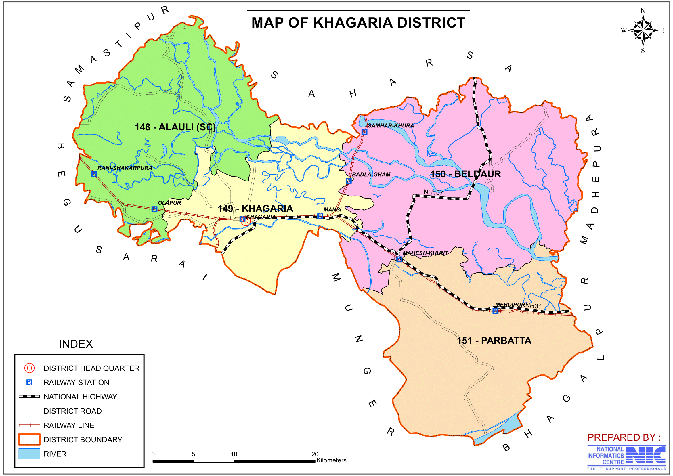
- 148- Alauli, 149- Khagaria, 150- Beldaur, 151- Parbatta
- Rivers: Ganges, Kamla Balan, Koshi, Budhi Gandak, Kareh, Kali Koshi and Bagmati
- Key Features:
- Located in a flood-prone region, with major rivers like the Ganga, Kosi, and Gandak passing through.
- Primarily an agrarian district producing paddy, maize, and wheat.
- Significance: Known for its agricultural economy and strategic location near major rivers.
- Time Zone: UTC+05:30 (IST)
- PIN Code: 8512XX
- Major Highways: NH-31, NH-107
- Average annual precipitation: 1182 mm
- Official Website: khagaria.nic.in
Geography
- Location: Khagaria is bordered by Begusarai to the west, Samastipur to the northwest, Saharsa and Madhepura to the north, Bhagalpur to the east, and Munger to the south.
- Area: The district spans an area of approximately 1,486 square kilometers.
- Rivers: Khagaria is surrounded by seven rivers, such as the Ganga, Kosi, Kamla Balan, Bagmati, Kareh, Kali Koshi and Budhi Gandak, which contribute to the region’s agricultural fertility.
- Climate: The district experiences a humid subtropical climate, with very hot summers, extremely cold winters and monsoon lasts until October, during which time the rivers overflow due to the intense rainfall, resulting in flooding in most areas.
History
- Historical Background: Khagaria’s name is believed to have originated from the word “Khag,” meaning birds, as the area was once rich in birdlife due to its wetlands.
- Colonial Era: During British rule, Khagaria was part of the Munger district and later the Saharsa subdivision. It was carved out as a separate district on 10 May 1981.
- Economic Growth: The district has grown over time due to its agricultural base and its strategic position as a transportation hub in eastern Bihar.
Ancient Era
The territory that is now part of Khagaria was once included in the old district of Munger and formed part of the Madhya-desa or “Midland,” which was considered the central region of the first Aryan settlers in India. This area has been identified with Modagiri, a place mentioned in the Mahabharata. Modagiri was the capital of a kingdom in Eastern India, located near Vanga (modern Bengal) and Tamralipta (an ancient port city in Bengal).
At the dawn of recorded history, the region was part of the Kingdom of Anga, one of the prominent Mahajanapadas (great kingdoms) mentioned in ancient Indian texts. The capital of Anga was Champa, near present-day Bhagalpur. The Kingdom of Anga encompassed the modern districts of Bhagalpur and Munger, extended northward to the Koshi River, and included parts of Purnea district. Rahul Sankrityayan, in his work Budh Charya, referred to the area north of the Ganga as Anguttarap, highlighting its historical significance.
7th-9th century A.D.
The first historical account of this region comes from the writings of Hiuen-Tsiang, the famous Chinese traveler and Buddhist monk, who visited parts of the old Munger district in the 7th century A.D. during the reign of Harsha. His travelogues provide a glimpse into the cultural and administrative aspects of the region at that time.
After Hiuen-Tsiang’s account, there is a gap in historical records until the 9th century A.D., when the region came under the control of the Pala dynasty. The Palas were a powerful dynasty in Eastern India known for their patronage of Buddhism and contributions to art, culture, and architecture. Historical details about the Pala period in this region are primarily derived from inscriptions found in southern Munger.
Following the decline of the Palas, the region experienced significant changes with the advent of Muslim rule in India. This marked the beginning of a new era in the history of the district, characterized by shifts in governance, culture, and religion.
This detailed account highlights the historical importance of the region through successive periods, from ancient Aryan settlements to the rule of the Palas and later under Muslim dominion.
Medival Era
Munger gained prominence in 1762 when Mir Kasim Ali Khan made it his capital, relocating treasures, elephants, and even the gold and silver decorations of the Imambara from Murshidabad. He fortified the town by building a palace with defensive structures for thirty guns and reorganized the army under General Gurghin Khan, an Armenian who introduced English-style training and established an arsenal. This marked the beginning of firearm manufacturing in Munger, an industry still present today. However, his tenure in Munger ended in 1763 after his conflict with the English led to the capture of the city.
Under British rule, Munger lost its significance as a frontier post but emerged as an administrative center in 1812. By 1814, its jurisdiction included five police divisions: Munger, Tarapur, Surajgarha, Malaypur, and Gogari. Over the years, the district expanded with the addition of Pargana Chakai from Ramgarh in 1834 and Pargana Bishazari from Patna in 1839. The most significant expansion occurred in 1874, when several areas, including Sakhrabadi, Darra, Singhaul, and Kharagpur, were transferred from Bhagalpur, covering an additional 613.62 square miles.
Subdivision under Munger
The creation of subdivisions further shaped the region’s administration. Jamui subdivision was formed in 1864, initially headquartered in Sikandra before being moved to Jamui in 1869. Begusarai subdivision was established in 1870, followed by Khagaria in 1943-44, which initially spanned 752 square miles and included seven police stations, including Khagaria, Gogari, and Chautham.
Parts of Khagaria were historically referred to as “Pharkiya Pargana”, which, according to the 1926 Gazetteer of Munger, primarily covered Gogri Thana. This area was granted as a zamindari to Biswanath Rai, a Rajput sent by the Delhi Emperor in the late 15th century to restore order. His descendants managed the estate for ten generations, though the later years saw significant violence and bloodshed. By 1926, the estate was under the ownership of Babu Kedarnath Goenka and Babu Deonandan Prasad.
Demographics (According to the 2011 Census)
- Population:
- Total Population: Khagaria district has a population of 1,666,886 (approximately 1.67 million).
- Ranking: 300th in India (out of 640 districts).
- Population Density: 1,115 inhabitants per square kilometer (2,890/sq mi).
- Population Growth (2001–2011): 29.46% reflecting significant population increase.
- Sex Ratio: 883 females per 1,000 males, indicating a gender disparity.
- Literacy Rate: The literacy rate is 63.45%, with ongoing efforts to improve access to education in rural areas.
- Urban Population: 5.23% of the total population lives in urban areas.
- Religious Composition (2011 Census):
- Hinduism: 89.21%
- Scheduled Castes: 14.83%
- Scheduled Tribes: 0.04%
- Islam: 10.53%
- Other or not stated: 0.26%
- Languages: The primary languages spoken are Hindi, Urdu, Maithili, Angika, and Bhojpuri.
- “Other” Hindi: 64.46%
- Hindi: 29.28%
- Urdu: 5.90%
- Others: 0.36%
Historical population of Khagaria District, Since 1901 to 2011
| Census Year | Persons | Variation since the preceding census (Absolute) | Variation since the preceding census (Percentage) | Males | Females |
|---|---|---|---|---|---|
| 1901 | 3,21,380 | – | – | 1,57,140 | 1,64,240 |
| 1911 | 3,31,441 | +10,061 | +3.13% | 1,61,970 | 1,69,471 |
| 1921 | 3,15,166 | -16,275 | -4.91% | 1,55,894 | 1,59,272 |
| 1931 | 3,54,889 | +39,723 | +12.60% | 1,77,633 | 1,77,256 |
| 1941 | 4,01,206 | +46,317 | +13.05% | 2,00,792 | 2,00,414 |
| 1951 | 4,43,401 | +42,195 | +10.52% | 2,28,669 | 2,14,732 |
| 1961 | 5,40,794 | +97,393 | +21.96% | 2,78,269 | 2,62,525 |
| 1971 | 6,41,202 | +1,00,408 | +18.57% | 3,38,596 | 3,02,606 |
| 1981 | 7,68,653 | +1,27,451 | +19.88% | 4,04,095 | 3,64,558 |
| 1991 | 9,87,227 | +2,18,574 | +28.44% | 5,28,632 | 4,58,595 |
| 2001 | 12,80,354 | +2,93,127 | +29.69% | 6,79,267 | 6,01,087 |
| 2011 | 16,66,886 | +3,86,532 | +30.19% | 8,83,786 | 7,83,100 |
Administration
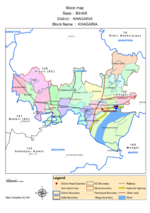
- Headquarters: Khagaria town serves as the district headquarters.
- Subdivisions:
- The district is divided into two subdivisions: Khagaria, Gogri, further divided into administrative blocks.
- Each subdivision is led by a subdivisional magistrate who is in charge of development, revenue-related tasks, and maintaining law and order.
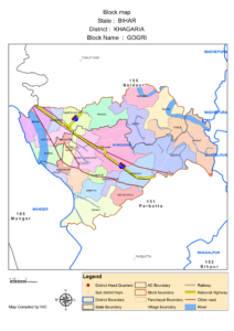
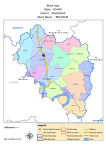
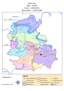
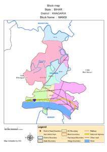
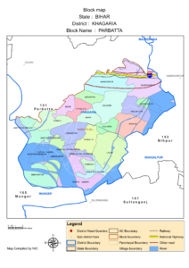
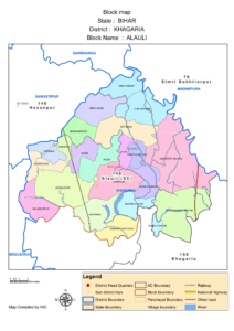
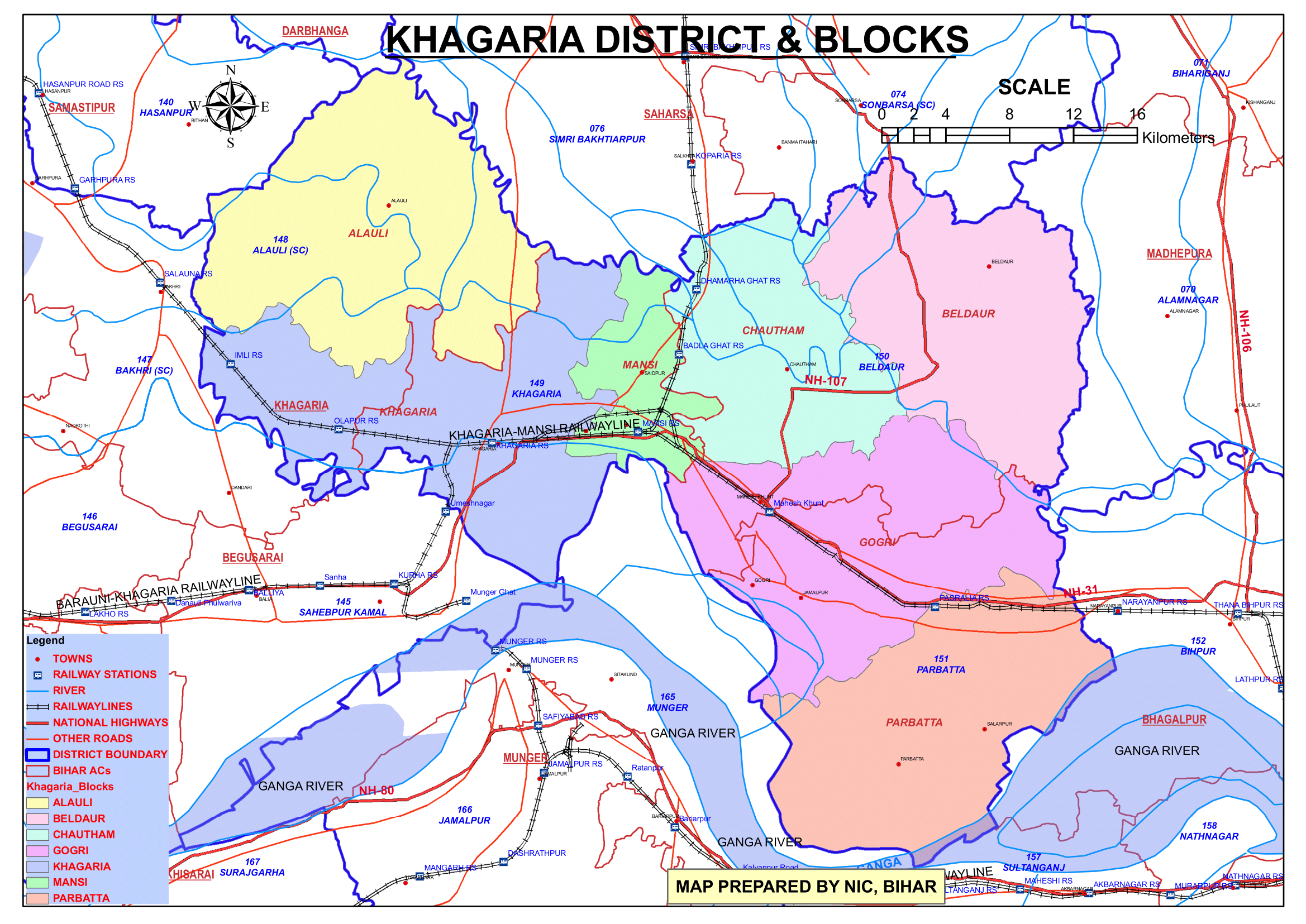
- Blocks and Circles:
- Khagaria district is divided into 7 Blocks and Circles such as Alauli, Khagaria, Chautham, Mansi, Gogri, Beldaur and Parbatta.
- A circle officer (CO) leads each circle, while a Block Development Officer (BDO) leads each block.
- Governance: Khagaria is part of the Munger division and has representation in both the Bihar Legislative Assembly and the Indian Parliament.
- Constituencies: Khagaria District falls under the 25 – Khagaria Parliamentary Constituency.
- Details of Constituencies:
- The 25 – Khagaria Parliamentary Constituency consists of six Assembly Constituencies:
- Four Assembly Constituencies are in Khagaria District.
- One Assembly Constituency is in Saharsa District.
- One Assembly Constituency is in Samastipur District.
- The 25 – Khagaria Parliamentary Constituency consists of six Assembly Constituencies:
- This configuration highlights Khagaria’s political significance and its interconnectedness with neighboring districts, making it a vital region for electoral processes in Bihar.
- Details of Constituencies:
- Constituencies: Khagaria District falls under the 25 – Khagaria Parliamentary Constituency.
Organization Chart

Economy
Khagaria is a district with significant economic potential, marked by recent developments and ongoing support for growth:
- Mega Food Park at Mansi Block:
- In 2015, Union Food Processing Minister Harsimrat Kaur Badal laid the foundation stone for a Mega Food Park at Mansi block.
- This project is expected to benefit 30,000 farmers.
- It will generate around 6,000 direct and indirect jobs, boosting employment in the region.
- In 2015, Union Food Processing Minister Harsimrat Kaur Badal laid the foundation stone for a Mega Food Park at Mansi block.
- Backward Regions Grant Fund Programme (BRGF):
- In 2006, Khagaria was identified as one of India’s 250 most backward districts by the Ministry of Panchayati Raj.
- The district is currently one of the 36 districts in Bihar receiving financial aid under the BRGF program, aimed at fostering development in underprivileged areas.
- These initiatives indicate Khagaria’s developmental trajectory while acknowledging the challenges it faces as a historically underdeveloped district.
- Agriculture: Agriculture is the primary economic activity in Khagaria, supported by the fertile alluvial plains and river systems. Major crops include:
- Paddy: The dominant crop of the region.
- Wheat, maize, lentils, and oilseeds.
- Horticulture crops like bananas and mangoes are also cultivated.
- Animal Husbandry: Dairy farming and cattle rearing are integral to the rural economy.
- Trade and Transport: The district’s strategic location at the intersection of rail and road networks makes it a hub for trade in agricultural products.
- Challenges: Seasonal flooding and waterlogging are persistent issues that impact agricultural productivity and infrastructure.
Education
- Schools and Colleges: Khagaria has a mix of government and private schools providing basic and secondary education. Higher education institutions include:
- Some Colleges:
- Koshi College, Khagaria
- Mahila College, Khagaria
- JNKT Inter School, Khagaria
- K D S College, Gogri, Khagaria
- K M D College, Parbatta, Khagaria
- Awadh Bihari Sanskrit College, Khagaria
- D.S.M. College (affiliated with Purnea University).
- Several vocational and training centers for skill development.
- Some Schools:
- Kendriya Vidyalaya, Khagaria
- Rose Bud Academy, Khagaria
- SL DAV Public School, Khagaria
- Bapu Madhya Vidyalay, Khagaria
- St. Xavier’s High School, Khagaria
- Arya Kanya High School, Khagaria
- Holi Ganges Public School, Khagaria
- Some Colleges:
- Literacy Challenges: Although the literacy rate is improving, rural areas still face a lack of educational infrastructure and resources.
Culture
- Festivals: Major festivals celebrated in Khagaria include Chhath Puja, Durga Puja, Diwali, Holi, and Eid. These reflect the district’s rich cultural diversity.
- Cuisine: The cuisine of Khagaria includes traditional Bihari dishes like litti chokha, pua, and sweets such as thekua and balushahi.
- Folk Traditions: Local folk music and dance are an integral part of celebrations and cultural events.
Tourism
Although Khagaria is not a prominent tourist destination, it offers some attractions:
- Riverside Views: The scenic beauty of rivers like the Ganga and Kosi attracts nature enthusiasts.
- Local Temples: Religious sites and temples in the district serve as spiritual centers for the local population.
- Historical Sites: The district has a few ancient structures and cultural landmarks reflecting its historical significance.
1. Katyayani Asthan
- Location: 12 kilometers from Jamui district headquarters.
- Significance:
- Katyayani Asthan houses the temple of Mother Katyayani, along with temples dedicated to Lord Rama, Lakshman, and Maa Janki.
- The site attracts numerous devotees, especially on Mondays and Fridays, for worship and offerings.
- Legend:
- The temple is linked to sage Katyayan, who performed penance on the banks of the Kaushik River (modern-day Koshi River). Pleased by his devotion, Mother Durga was born as his daughter and became known as Katyayani.
- Approximately 300 years ago, Bhakta Sripat Maharaj dreamt of Mother Katyayani and, under divine guidance, constructed this temple surrounded by dense forests.
2. Shyamlal National High School
- Established: 1910 AD.
- Significance:
- The school was built on land generously donated by Shri Shyamlal.
- It played a crucial role in India’s freedom movement, serving as a prominent meeting spot for revolutionaries.
- The contributions of the students and teachers to the independence struggle have left a lasting legacy.
3. Azgaibinath Mahadev Temple
- Location: Sultanganj (Bhagalpur district), close to Aguwanighat in Khagaria district.
- Temple Features:
- Dedicated to Lord Shiva, the temple is situated on a high hill overlooking the Ganga River.
- The scenic surroundings and proximity to the river make it a spiritual hub for devotees.
- Significance:
- Devotees bathe in the Ganga River before ascending to the temple to offer prayers to Lord Shiva.
- The unique combination of a riverside location and hilltop temple creates an aura of divinity, drawing pilgrims in large numbers.
These locations, each steeped in history and spiritual significance, make Jamui and its surrounding areas a rich tourism destination. From ancient legends to freedom movement landmarks, the district offers a diverse cultural experience for visitors.
Transportation
Khagaria serves as an important transportation hub due to its location:
- Railways:
- Khagaria Junction is a critical railway station on the Delhi-Guwahati route, connecting the district to major cities across India.
- The Barauni-Katihar railway line passes through the district, enhancing connectivity.
- It connects Khagaria to the rest of North Bihar via rail lines to Saharsa and Samastipur.
- The Munger Rail Bridge over the Ganges River links Khagaria directly to South Bihar and Jharkhand, enhancing accessibility and connectivity.
- Roadways: The district is well-connected by state highways and roads, although rural connectivity needs improvement.
- National Highway No. 31 runs through Khagaria, serving as a vital corridor connecting the rest of India to the North Eastern Region.
- The combination of rail and road infrastructure positions Khagaria as an important transit hub, facilitating movement across Bihar and beyond.
- Waterways: The Ganga River offers potential for inland water transport and trade.
- Airways: The nearest airport is in Patna, approximately 150 km away, providing regional and national connectivity.
Challenges
- Flooding: The district faces frequent flooding from the Kosi and other rivers, leading to displacement, loss of agricultural crops, and infrastructure damage.
- Infrastructure Development: There is a need for better healthcare, education, and road infrastructure, especially in rural areas.
- Poverty and Unemployment: Despite agricultural and trade potential, the district experiences significant out-migration due to limited local employment opportunities.
Conclusion
Khagaria is a district with immense potential due to its fertile lands, strategic location, and transportation network. Despite challenges like flooding and infrastructure gaps, the district is steadily progressing. Investments in flood management, education, industrialization, and rural development can transform Khagaria into a more prosperous and sustainable region. Its agricultural base and cultural vibrancy remain key assets for future growth.
Would you like more details about any specific Topics on Bihar? Comment Below or Checkout these topics
खगड़िया जिला: नदियों और लचीलेपन का एक विशेष केंद्र
अवलोकन
खगड़िया जिला भारत के बिहार राज्य के पूर्वोत्तर भाग में स्थित 38-जिलों में से एक है। यह जिला 1,485 km2 (573 वर्ग मील) के क्षेत्र में फैला हुआ है, जो पश्चिम में बेगूसराय जिले, उत्तर-पश्चिम में समस्तीपुर जिले, उत्तर में सहरसा जिले और मधेपुरा जिले, पूर्व में भागलपुर जिले और दक्षिण में मुंगेर जिले से घिरा हुआ है। जिले का प्रशासनिक केंद्र खगड़िया शहर में स्थित है। यह जिला मुंगेर डिवीजन का हिस्सा है।
मुंगेर जिले से अलग होने के बाद, 10 मई 1981 को इस जिले की स्थापना की गई थी, यह अपने उपजाऊ मैदानों, कृषि उत्पादकता और एक महत्वपूर्ण परिवहन केंद्र के रूप में अपनी स्थिति के लिए जाना जाता है। यह जिला कई नदियों से घिरा हुआ है, जो इसे कृषि की दृष्टि से समृद्ध और मौसमी बाढ़ से ग्रस्त बनाता है। चुनौतियों के बावजूद, खगड़िया बिहार के सामाजिक-आर्थिक ढांचे में एक महत्वपूर्ण भूमिका निभाता है।
जिले का गठन
खगड़िया मूल रूप से मुंगेर जिले का हिस्सा था, जो एक उपखंड के रूप में कार्य करता था। इसे 1943-44 में एक उपखंड के रूप में बनाया गया था और बाद में बिहार सरकार की अधिसूचना संख्या 7/T-1-207/79 दिनांक 30 अप्रैल 1981 के अनुसार 10 मई 1981 को इसे एक जिले में अपग्रेड किया गया। स्वतंत्रता से पहले, खगड़िया मुंगेर का सबसे नया उपखंड था, जिसमें पुराने उपखंड मुंगेर सदर, जमुई (22 जुलाई 1864 को बनाया गया) और बेगूसराय (14 फरवरी 1870 को बनाया गया) थे।
क्षेत्र में संचार कठिनाइयों के कारण खगड़िया को एक अलग उपखंड बनाया गया था। रेलवे ने जिले की परिवहन प्रणाली में महत्वपूर्ण भूमिका निभाई।
1960 तक, खगड़िया में तीन रेलवे लाइनें थीं:
- पश्चिम से पूर्व की ओर चलने वाली पूर्वोत्तर रेलवे में चार स्टेशन थे- खगड़िया, मानसी, महेशखूंट और पसराहा।
- खगड़िया से एक शाखा लाइन ओलापुर और इमली से होकर गुज़री।
- मानसी से एक और शाखा लाइन सहरसा तक फैली हुई थी, हालांकि कत्यानी अस्थान और कोपरिया के बीच बरसात के मौसम में इसे समस्याओं का सामना करना पड़ा, जिसके कारण छह मील के इस हिस्से को नावों से तय करना पड़ा।
उस समय सड़क का बुनियादी ढांचा न्यूनतम था। एकमात्र पक्की सड़क 22 मील लंबी महेशखूंट-अगुवानी घाट सड़क थी, जो अभी भी निर्माणाधीन थी। खगड़िया-परिहारा-बखरी सड़क और मोकामाघाट को असम से जोड़ने वाली राष्ट्रीय राजमार्ग जैसी अन्य सड़कें या तो निर्माणाधीन थीं या योजना के चरण में थीं।
पुरातात्विक या ऐतिहासिक स्थलों की कमी के पीछे का कारण
बाढ़ एक आवर्ती समस्या थी, जो पाँच प्रमुख नदियों – गंगा, गंडक, बागमती, कमला और कोशी – के कारण होती थी, जो इस क्षेत्र से होकर गुजरती थीं। बाढ़ और जलभराव के कारण संचार बेहद चुनौतीपूर्ण हो जाता था, खासकर बरसात के मौसम में। बागमती के दक्षिणी तटबंध और गोगरी-नारायणपुर तटबंध जैसे तटबंधों के निर्माण से पहले, रेलवे लाइन और नदियों (जिसमें मरिया और मैथा जैसी छोटी धाराएँ भी शामिल हैं) के बीच की ज़मीन का बड़ा हिस्सा दलदली और जलमग्न था।
ऐतिहासिक रूप से, इस क्षेत्र में महत्वपूर्ण पुरातात्विक या ऐतिहासिक स्थलों का अभाव था, संभवतः अक्सर बाढ़ आने के कारण। ऐसा कहा जाता है कि सम्राट अकबर के शासनकाल के दौरान, राजा टोडरमल को इस क्षेत्र का सर्वेक्षण करने के लिए नियुक्त किया गया था। हालाँकि, चुनौतीपूर्ण भूगोल के कारण, वह असफल रहे और उन्होंने इस क्षेत्र को बाहर करने की सिफारिश की, इसे “फ़रक किया” (बहिष्कृत) कहा। ऐसा माना जाता है कि यह “फ़रकिया परगना” नाम की उत्पत्ति है, जिसे बाद में खगड़िया से जोड़ा गया।
खगड़िया जिले के बारे में मुख्य तथ्य
- देश: भारत
- राज्य: बिहार
- प्रमंडल: मुंगेर
- स्थापना: 10 मई 1981
- क्षेत्रफल: 1,485 km2 (573 वर्ग मील)
- निर्देशांक: 25°30′00″N 86°28′12″E
- जिला मुख्यालय: खगड़िया
- वर्तमान जिला मजिस्ट्रेट (डी.एम.): अमित कुमार पांडे, आईएएस
- वर्तमान पुलिस अधीक्षक (एस.पी.): चंदन कुमार कुशवाहा, आईपीएस
- जनसंख्या (2011):
- कुल: 1,666,886
- घनत्व: 1,100/km2 (2,900/वर्ग मील)
- साक्षरता दर: 72.87%
- लिंगानुपात: 886/1000
- राजभाषा: हिंदी
- क्षेत्रीय भाषा: अंगिका
- ग्राम पंचायतें: 113
- गांव: 306
- उपखंड की संख्या: 2 (खगड़िया, गोगरी)
- पुलिस स्टेशन: 25
- ब्लॉकों की संख्या: 7 (अलौली, खगड़िया, चौथम, मानसी, गोगरी, बेलदौर, परबत्ता)
- नगर परिषद: 1 (खगड़िया)
- नगर पंचायत: 1 (गोगरी)
- लोकसभा क्षेत्र: 1 (खगड़िया)
- विधान सभा क्षेत्र: 4 (अलौली, खगड़िया, बेलदौर, परबत्ता)
- नदियाँ: गंगा, कमला बलान, कोशी, बूढ़ी गंडक, करेह, काली कोशी और बागमती
- प्रमुख विशेषताऐं:
- बाढ़-प्रवण क्षेत्र में स्थित है, जहाँ से गंगा, कोसी और गंडक जैसी प्रमुख नदियाँ गुजरती हैं।
- मुख्य रूप से धान, मक्का और गेहूं का उत्पादन करने वाला कृषि प्रधान जिला।
- महत्व: अपनी कृषि अर्थव्यवस्था और प्रमुख नदियों के निकट रणनीतिक स्थान के लिए जाना जाता है।
- समय क्षेत्र: UTC+05:30 (IST)
- पिन कोड: 8512XX
- प्रमुख राजमार्ग: NH-31, NH-107
- औसत वार्षिक वर्षा: 1182 mm
- आधिकारिक वेबसाइट: khagaria.nic.in
भूगोल
- स्थान: खगड़िया की सीमा पश्चिम में बेगूसराय, उत्तर-पश्चिम में समस्तीपुर, उत्तर में सहरसा और मधेपुरा, पूर्व में भागलपुर और दक्षिण में मुंगेर से लगती है।
- क्षेत्र: जिला लगभग 1,486 वर्ग किलोमीटर में फैला हुआ है।
- नदियाँ: खगड़िया सात नदियों से घिरा हुआ है, जैसे गंगा, कोसी, कमला बलान, बागमती, करेह, काली कोशी और बूढ़ी गंडक, जो इस क्षेत्र की कृषि उर्वरता में योगदान करती हैं।
- जलवायु: जिले में आर्द्र उपोष्णकटिबंधीय जलवायु होती है, जिसमें बहुत गर्म ग्रीष्मकाल, बहुत ठंडी सर्दियाँ होती हैं और मानसून अक्टूबर तक रहता है, इस दौरान भारी वर्षा के कारण नदियाँ उफान पर होती हैं, जिसके परिणामस्वरूप अधिकांश क्षेत्रों में बाढ़ आ जाती है।
इतिहास
- ऐतिहासिक पृष्ठभूमि: माना जाता है कि खगड़िया का नाम “खग” शब्द से आया है, जिसका अर्थ पक्षी होता है, क्योंकि यह क्षेत्र कभी अपनी आर्द्रभूमि के कारण पक्षियों से समृद्ध था।
- औपनिवेशिक काल: ब्रिटिश शासन के दौरान, खगड़िया मुंगेर जिले का हिस्सा था और बाद में सहरसा उपखंड का हिस्सा बन गया। इसे 10 मई 1981 को एक अलग जिले के रूप में बनाया गया था।
- आर्थिक विकास: कृषि आधार और पूर्वी बिहार में परिवहन केंद्र के रूप में अपनी रणनीतिक स्थिति के कारण जिले का समय के साथ विकास हुआ है।
प्राचीन काल
वह क्षेत्र जो अब खगड़िया का हिस्सा है, कभी मुंगेर के पुराने जिले में शामिल था और मध्य-देश या “मिडलैंड” का हिस्सा था, जिसे भारत में पहले आर्यन बसने वालों का केंद्रीय क्षेत्र माना जाता था। इस क्षेत्र की पहचान महाभारत में वर्णित मोदगिरी नामक स्थान से की गई है। मोदगिरी पूर्वी भारत में एक राज्य की राजधानी थी, जो वंगा (आधुनिक बंगाल) और ताम्रलिप्ता (बंगाल का एक प्राचीन बंदरगाह शहर) के पास स्थित थी।
लिखित इतिहास की शुरुआत में, यह क्षेत्र प्राचीन भारतीय ग्रंथों में वर्णित प्रमुख महाजनपदों (महान साम्राज्यों) में से एक अंग राज्य का हिस्सा था। अंग की राजधानी चंपा थी, जो वर्तमान भागलपुर के पास है। अंग राज्य में भागलपुर और मुंगेर के आधुनिक जिले शामिल थे, जो उत्तर की ओर कोशी नदी तक फैले हुए थे और इसमें पूर्णिया जिले के कुछ हिस्से शामिल थे। राहुल सांकृत्यायन ने अपने काम बुद्ध चर्या में, गंगा के उत्तर में स्थित क्षेत्र को अंगुत्तरप के रूप में संदर्भित किया, जो इसके ऐतिहासिक महत्व पर प्रकाश डालता है।
7वीं-9वीं शताब्दी ई.
इस क्षेत्र का पहला ऐतिहासिक विवरण प्रसिद्ध चीनी यात्री और बौद्ध भिक्षु ह्वेन-त्सियांग के लेखन से आता है, जिन्होंने हर्ष के शासनकाल के दौरान 7वीं शताब्दी ई. में पुराने मुंगेर जिले के कुछ हिस्सों का दौरा किया था। उनके यात्रा वृत्तांत उस समय के क्षेत्र के सांस्कृतिक और प्रशासनिक पहलुओं की झलक प्रदान करते हैं।
ह्वेन-त्सियांग के विवरण के बाद, 9वीं शताब्दी ई. तक ऐतिहासिक अभिलेखों में अंतराल है, जब यह क्षेत्र पाल वंश के नियंत्रण में आ गया। पाल पूर्वी भारत में एक शक्तिशाली राजवंश थे, जो बौद्ध धर्म के संरक्षण और कला, संस्कृति और वास्तुकला में योगदान के लिए जाने जाते थे। इस क्षेत्र में पाल काल के बारे में ऐतिहासिक विवरण मुख्य रूप से दक्षिणी मुंगेर में पाए गए शिलालेखों से प्राप्त होते हैं।
पालों के पतन के बाद, भारत में मुस्लिम शासन के आगमन के साथ इस क्षेत्र में महत्वपूर्ण परिवर्तन हुए। इसने जिले के इतिहास में एक नए युग की शुरुआत की, जिसकी विशेषता शासन, संस्कृति और धर्म में बदलाव थी।
यह विस्तृत विवरण प्राचीन आर्य बस्तियों से लेकर पालों के शासन और बाद में मुस्लिम शासन के दौरान लगातार अवधियों के माध्यम से क्षेत्र के ऐतिहासिक महत्व को उजागर करता है।
मध्यकालीन युग
मुंगेर ने 1762 में प्रमुखता हासिल की जब मीर कासिम अली खान ने इसे अपनी राजधानी बनाया, खजाने, हाथियों और यहां तक कि मुर्शिदाबाद से इमामबाड़े की सोने और चांदी की सजावट को स्थानांतरित किया। उन्होंने तीस तोपों के लिए रक्षात्मक संरचनाओं के साथ एक महल का निर्माण करके शहर को मजबूत किया और जनरल गुरगिन खान के तहत सेना को पुनर्गठित किया, जो एक अर्मेनियाई थे जिन्होंने अंग्रेजी शैली के प्रशिक्षण की शुरुआत की और एक शस्त्रागार की स्थापना की। इसने मुंगेर में आग्नेयास्त्र निर्माण की शुरुआत की, एक उद्योग जो आज भी मौजूद है। हालाँकि, मुंगेर में उनका कार्यकाल 1763 में समाप्त हो गया जब अंग्रेजों के साथ उनके संघर्ष के कारण शहर पर कब्जा हो गया।
ब्रिटिश शासन के तहत, मुंगेर ने सीमांत चौकी के रूप में अपना महत्व खो दिया, लेकिन 1812 में एक प्रशासनिक केंद्र के रूप में उभरा। 1814 तक, इसके अधिकार क्षेत्र में पाँच पुलिस प्रभाग शामिल थे: मुंगेर, तारापुर, सूरजगढ़ा, मलयपुर और गोगरी। वर्षों से, 1834 में रामगढ़ से परगना चकाई और 1839 में पटना से परगना बिशाजारी को जोड़ने के साथ जिले का विस्तार हुआ। सबसे महत्वपूर्ण विस्तार 1874 में हुआ, जब सखराबादी, दर्रा, सिंघौल और खड़गपुर सहित कई क्षेत्रों को भागलपुर से स्थानांतरित किया गया, जिससे अतिरिक्त 613.62 वर्ग मील क्षेत्र शामिल हो गया।
मुंगेर के अधीन उपविभाग
उपविभागों के निर्माण ने क्षेत्र के प्रशासन को और आकार दिया। जमुई अनुमंडल का गठन 1864 में हुआ था, जिसका मुख्यालय शुरू में सिकंदरा में था, जिसे 1869 में जमुई में स्थानांतरित कर दिया गया। बेगूसराय अनुमंडल की स्थापना 1870 में हुई, उसके बाद 1943-44 में खगड़िया अनुमंडल की स्थापना हुई, जो शुरू में 752 वर्ग मील में फैला था और इसमें खगड़िया, गोगरी और चौथम सहित सात पुलिस स्टेशन शामिल थे।
खगड़िया के कुछ हिस्सों को ऐतिहासिक रूप से “फरकिया परगना” के रूप में जाना जाता था, जो मुंगेर के 1926 के गजेटियर के अनुसार, मुख्य रूप से गोगरी थाना को कवर करता था। यह क्षेत्र 15वीं शताब्दी के अंत में दिल्ली सम्राट द्वारा व्यवस्था बहाल करने के लिए भेजे गए राजपूत बिस्वनाथ राय को जमींदारी के रूप में दिया गया था। उनके वंशजों ने दस पीढ़ियों तक संपत्ति का प्रबंधन किया, हालांकि बाद के वर्षों में काफी हिंसा और रक्तपात हुआ। 1926 तक, संपत्ति बाबू केदारनाथ गोयनका और बाबू देवनंदन प्रसाद के स्वामित्व में थी।
जनसांख्यिकी (2011 की जनगणना के अनुसार)
- जनसंख्या:
- कुल जनसंख्या: खगड़िया जिले की जनसंख्या 1,666,886 (लगभग 1.67 मिलियन) है।
- रैंकिंग: भारत में 300वाँ स्थान (640 जिलों में से)।
- जनसंख्या घनत्व: प्रति वर्ग किलोमीटर 1,115 निवासी (2,890/वर्ग मील)।
- जनसंख्या वृद्धि (2001-2011): 29.46% जो महत्वपूर्ण जनसंख्या वृद्धि को दर्शाता है।
- लिंग अनुपात: प्रति 1,000 पुरुषों पर 883 महिलाएँ, जो लैंगिक असमानता को दर्शाता है।
- साक्षरता दर: साक्षरता दर 63.45% है, ग्रामीण क्षेत्रों में शिक्षा तक पहुँच में सुधार के लिए निरंतर प्रयास किए जा रहे हैं।
- शहरी जनसंख्या: कुल जनसंख्या का 5.23% शहरी क्षेत्रों में रहता है।
- धार्मिक संरचना (2011 की जनगणना):
- हिंदू धर्म: 89.21%
- अनुसूचित जाति: 14.83%
- अनुसूचित जनजाति: 0.04%
- इस्लाम: 10.53%
- अन्य या नहीं बताया गया: 0.26%
- भाषाएँ: बोली जाने वाली मुख्य भाषाएँ हिंदी, उर्दू, मैथिली, अंगिका और भोजपुरी हैं।
- “अन्य” हिंदी: 64.46%
- हिंदी: 29.28%
- उर्दू: 5.90%
- अन्य: 0.36%
प्रशासन
- मुख्यालय: खगड़िया शहर जिला मुख्यालय के रूप में कार्य करता है।
- उपविभाग:
- जिले को दो अनुमंडलों में विभाजित किया गया है: खगड़िया, गोगरी, जो आगे प्रशासनिक ब्लॉकों में विभाजित हैं।
- प्रत्येक अनुमंडल का नेतृत्व एक अनुमंडलीय मजिस्ट्रेट करता है जो विकास, राजस्व संबंधी कार्यों और कानून व्यवस्था बनाए रखने का प्रभारी होता है।
- ब्लॉक और सर्किल:
- खगड़िया जिले को 7 ब्लॉक और सर्किल में विभाजित किया गया है जैसे अलौली, खगड़िया, चौथम, मानसी, गोगरी, बेलदौर और परबत्ता।
- प्रत्येक सर्किल का नेतृत्व एक सर्किल अधिकारी (सीओ) करता है, जबकि प्रत्येक ब्लॉक का नेतृत्व एक ब्लॉक विकास अधिकारी (बीडीओ) करता है।
- शासन: खगड़िया मुंगेर प्रमंडल का हिस्सा है और इसका बिहार विधानसभा और भारतीय संसद दोनों में प्रतिनिधित्व है।
- निर्वाचन क्षेत्र: खगड़िया जिला 25-खगड़िया संसदीय क्षेत्र के अंतर्गत आता है।
- निर्वाचन क्षेत्रों का विवरण:
- 25-खगड़िया संसदीय क्षेत्र में छह विधानसभा क्षेत्र शामिल हैं:
- खगड़िया जिले में चार विधानसभा क्षेत्र हैं।
- एक विधानसभा क्षेत्र सहरसा जिले में है।
- एक विधानसभा क्षेत्र समस्तीपुर जिले में है।
- 25-खगड़िया संसदीय क्षेत्र में छह विधानसभा क्षेत्र शामिल हैं:
- निर्वाचन क्षेत्रों का विवरण:
- यह संरचना खगड़िया के राजनीतिक महत्व और पड़ोसी जिलों के साथ इसके अंतर्संबंध को उजागर करती है, जिससे यह बिहार में चुनावी प्रक्रियाओं के लिए एक महत्वपूर्ण क्षेत्र बन जाता है।
- निर्वाचन क्षेत्र: खगड़िया जिला 25-खगड़िया संसदीय क्षेत्र के अंतर्गत आता है।
अर्थव्यवस्था
खगड़िया एक ऐसा जिला है जिसकी आर्थिक क्षमता काफी अधिक है, हाल ही में हुए विकास और विकास के लिए निरंतर समर्थन के कारण:
- मानसी ब्लॉक में मेगा फूड पार्क:
- 2015 में, केंद्रीय खाद्य प्रसंस्करण मंत्री हरसिमरत कौर बादल ने मानसी ब्लॉक में मेगा फूड पार्क की आधारशिला रखी।
- इस परियोजना से 30,000 किसानों को लाभ मिलने की उम्मीद है।
- इससे लगभग 6,000 प्रत्यक्ष और अप्रत्यक्ष नौकरियां पैदा होंगी, जिससे क्षेत्र में रोजगार को बढ़ावा मिलेगा।
- 2015 में, केंद्रीय खाद्य प्रसंस्करण मंत्री हरसिमरत कौर बादल ने मानसी ब्लॉक में मेगा फूड पार्क की आधारशिला रखी।
- पिछड़ा क्षेत्र अनुदान निधि कार्यक्रम (BRGF):
- 2006 में, पंचायती राज मंत्रालय द्वारा खगड़िया को भारत के 250 सबसे पिछड़े जिलों में से एक के रूप में पहचाना गया था।
- यह जिला वर्तमान में बिहार के उन 36 जिलों में से एक है, जिन्हें BRGF कार्यक्रम के तहत वित्तीय सहायता मिल रही है, जिसका उद्देश्य वंचित क्षेत्रों में विकास को बढ़ावा देना है।
- ये पहल खगड़िया के विकास की दिशा को दर्शाती हैं, जबकि ऐतिहासिक रूप से अविकसित जिले के रूप में इसके सामने आने वाली चुनौतियों को स्वीकार करती हैं।
- कृषि: खगड़िया में कृषि प्राथमिक आर्थिक गतिविधि है, जो उपजाऊ जलोढ़ मैदानों और नदी प्रणालियों द्वारा समर्थित है। प्रमुख फसलों में शामिल हैं:
- धान: इस क्षेत्र की प्रमुख फसल।
- गेहूँ, मक्का, दाल और तिलहन।
- केले और आम जैसी बागवानी फसलें भी उगाई जाती हैं।
- पशुपालन: डेयरी फार्मिंग और मवेशी पालन ग्रामीण अर्थव्यवस्था का अभिन्न अंग हैं।
- व्यापार और परिवहन: रेल और सड़क नेटवर्क के चौराहे पर जिले का रणनीतिक स्थान इसे कृषि उत्पादों के व्यापार का केंद्र बनाता है।
- चुनौतियाँ: मौसमी बाढ़ और जलभराव लगातार समस्याएँ हैं जो कृषि उत्पादकता और बुनियादी ढाँचे को प्रभावित करती हैं।
शिक्षा
- स्कूल और कॉलेज: खगड़िया में बुनियादी और माध्यमिक शिक्षा प्रदान करने वाले सरकारी और निजी स्कूलों का मिश्रण है। उच्च शिक्षा संस्थानों में शामिल हैं:
- कुछ कॉलेज:
- कोशी कॉलेज, खगड़िया
- महिला कॉलेज, खगड़िया
- जेएनकेटी इंटर स्कूल, खगड़िया
- के डी एस कॉलेज, गोगरी, खगड़िया
- के एम डी कॉलेज, परबत्ता, खगड़िया
- अवध बिहारी संस्कृत महाविद्यालय, खगड़िया
- डी.एस.एम. कॉलेज (पूर्णिया विश्वविद्यालय से संबद्ध)।
- कौशल विकास के लिए कई व्यावसायिक और प्रशिक्षण केंद्र।
- कुछ स्कूल:
- केन्द्रीय विद्यालय, खगड़िया
- रोज़ बड अकादमी, खगड़िया
- एसएल डीएवी पब्लिक स्कूल, खगड़िया
- बापू मध्य विद्यालय, खगड़िया
- सेंट जेवियर्स हाई स्कूल, खगड़िया
- आर्य कन्या उच्च विद्यालय, खगड़िया
- होली गैंगेज पब्लिक स्कूल, खगड़िया
- कुछ कॉलेज:
- साक्षरता चुनौतियाँ: हालाँकि साक्षरता दर में सुधार हो रहा है, फिर भी ग्रामीण क्षेत्रों में शैक्षिक बुनियादी ढांचे और संसाधनों की कमी है।
संस्कृति
- त्यौहार: खगड़िया में मनाए जाने वाले प्रमुख त्यौहारों में छठ पूजा, दुर्गा पूजा, दिवाली, होली और ईद शामिल हैं। ये जिले की समृद्ध सांस्कृतिक विविधता को दर्शाते हैं।
- व्यंजन: खगड़िया के व्यंजनों में लिट्टी चोखा, पुआ जैसे पारंपरिक बिहारी व्यंजन और ठेकुआ और बालूशाही जैसी मिठाइयाँ शामिल हैं।
- लोक परंपराएँ: स्थानीय लोक संगीत और नृत्य उत्सवों और सांस्कृतिक कार्यक्रमों का एक अभिन्न अंग हैं।
पर्यटन
हालाँकि खगड़िया एक प्रमुख पर्यटन स्थल नहीं है, लेकिन यह कुछ आकर्षण प्रदान करता है:
- नदी के किनारे का नज़ारा: गंगा और कोसी जैसी नदियों की प्राकृतिक सुंदरता प्रकृति प्रेमियों को आकर्षित करती है।
- स्थानीय मंदिर: जिले में धार्मिक स्थल और मंदिर स्थानीय आबादी के लिए आध्यात्मिक केंद्र के रूप में काम करते हैं।
- ऐतिहासिक स्थल: जिले में कुछ प्राचीन संरचनाएँ और सांस्कृतिक स्थल हैं जो इसके ऐतिहासिक महत्व को दर्शाते हैं।
1. कात्यायनी स्थान
- स्थान: जमुई जिला मुख्यालय से 12 किलोमीटर दूर।
- महत्व:
- कात्यायनी अस्थान में भगवान राम, लक्ष्मण और मां जानकी को समर्पित मंदिरों के साथ-साथ माता कात्यायनी का मंदिर भी है।
- यह स्थल, विशेष रूप से सोमवार और शुक्रवार को पूजा और प्रसाद के लिए बड़ी संख्या में भक्तों को आकर्षित करता है।
- किंवदंती:
- यह मंदिर ऋषि कात्यायन से जुड़ा हुआ है, जिन्होंने कौशिक नदी (आधुनिक कोशी नदी) के तट पर तपस्या की थी। उनकी भक्ति से प्रसन्न होकर, माँ दुर्गा ने उनकी पुत्री के रूप में जन्म लिया और कात्यायनी के रूप में जानी गईं।
- लगभग 300 साल पहले, भक्त श्रीपत महाराज ने माँ कात्यायनी का सपना देखा और दिव्य मार्गदर्शन में, घने जंगलों से घिरे इस मंदिर का निर्माण किया।
2. श्यामलाल राष्ट्रीय उच्च विद्यालय
- स्थापना: 1910 ई.
- महत्व:
- यह विद्यालय श्री श्यामलाल द्वारा उदारतापूर्वक दान की गई भूमि पर बनाया गया था।
- इसने भारत के स्वतंत्रता आंदोलन में महत्वपूर्ण भूमिका निभाई, क्रांतिकारियों के लिए एक प्रमुख बैठक स्थल के रूप में कार्य किया।
- स्वतंत्रता संग्राम में छात्रों और शिक्षकों के योगदान ने एक स्थायी विरासत छोड़ी है।
3. अजगैबीनाथ महादेव मंदिर
- स्थान: सुल्तानगंज (भागलपुर जिला), खगड़िया जिले में अगुवानीघाट के करीब।
- मंदिर की विशेषताएँ:
- भगवान शिव को समर्पित, यह मंदिर गंगा नदी के किनारे एक ऊँची पहाड़ी पर स्थित है।
- सुंदर परिवेश और नदी से निकटता इसे भक्तों के लिए एक आध्यात्मिक केंद्र बनाती है।
- महत्व:
- भक्त भगवान शिव की पूजा करने के लिए मंदिर में चढ़ने से पहले गंगा नदी में स्नान करते हैं।
- नदी के किनारे स्थित स्थान और पहाड़ी पर स्थित मंदिर का अनूठा संयोजन दिव्यता का आभास पैदा करता है, जो बड़ी संख्या में तीर्थयात्रियों को आकर्षित करता है।
- ये स्थान, जिनमें से प्रत्येक इतिहास और आध्यात्मिक महत्व से भरा हुआ है, जमुई और इसके आसपास के क्षेत्रों को एक समृद्ध पर्यटन स्थल बनाते हैं। प्राचीन किंवदंतियों से लेकर स्वतंत्रता आंदोलन के स्थलों तक, यह जिला आगंतुकों के लिए विविध सांस्कृतिक अनुभव प्रदान करता है।
परिवहन
खगड़िया अपने स्थान के कारण एक महत्वपूर्ण परिवहन केंद्र के रूप में कार्य करता है:
- रेलवे:
- खगड़िया जंक्शन दिल्ली-गुवाहाटी मार्ग पर एक महत्वपूर्ण रेलवे स्टेशन है, जो जिले को भारत भर के प्रमुख शहरों से जोड़ता है।
- बरौनी-कटिहार रेलवे लाइन जिले से होकर गुजरती है, जिससे कनेक्टिविटी बढ़ती है।
- यह खगड़िया को सहरसा और समस्तीपुर तक रेल लाइनों के माध्यम से शेष उत्तर बिहार से जोड़ती है।
- गंगा नदी पर मुंगेर रेल पुल खगड़िया को सीधे दक्षिण बिहार और झारखंड से जोड़ता है, जिससे पहुँच और कनेक्टिविटी बढ़ती है।
- सड़क मार्ग: जिला राज्य राजमार्गों और सड़कों से अच्छी तरह से जुड़ा हुआ है, हालाँकि ग्रामीण कनेक्टिविटी में सुधार की आवश्यकता है।
- राष्ट्रीय राजमार्ग संख्या 31 खगड़िया से होकर गुजरता है, जो शेष भारत को पूर्वोत्तर क्षेत्र से जोड़ने वाले एक महत्वपूर्ण गलियारे के रूप में कार्य करता है।
- रेल और सड़क अवसंरचना का संयोजन खगड़िया को एक महत्वपूर्ण पारगमन केंद्र के रूप में स्थापित करता है, जो पूरे बिहार और उससे आगे आवागमन को सुविधाजनक बनाता है।
- जलमार्ग: गंगा नदी अंतर्देशीय जल परिवहन और व्यापार की संभावना प्रदान करती है।
- वायुमार्ग: निकटतम हवाई अड्डा पटना में है, जो लगभग 150 किमी दूर है, जो क्षेत्रीय और राष्ट्रीय संपर्क प्रदान करता है।
चुनौतियाँ
- बाढ़: जिले में कोसी और अन्य नदियों से अक्सर बाढ़ आती है, जिससे विस्थापन, कृषि फसलों का नुकसान और बुनियादी ढाँचे को नुकसान होता है।
- बुनियादी ढाँचा विकास: बेहतर स्वास्थ्य सेवा, शिक्षा और सड़क बुनियादी ढाँचे की ज़रूरत है, खासकर ग्रामीण इलाकों में।
- गरीबी और बेरोज़गारी: कृषि और व्यापार क्षमता के बावजूद, सीमित स्थानीय रोज़गार के अवसरों के कारण जिले में काफ़ी संख्या में लोग पलायन करते हैं।
निष्कर्ष
खगड़िया अपनी उपजाऊ भूमि, रणनीतिक स्थान और परिवहन नेटवर्क के कारण अपार संभावनाओं वाला जिला है। बाढ़ और बुनियादी ढाँचे की कमी जैसी चुनौतियों के बावजूद, जिला लगातार प्रगति कर रहा है। बाढ़ प्रबंधन, शिक्षा, औद्योगीकरण और ग्रामीण विकास में निवेश खगड़िया को और अधिक समृद्ध और टिकाऊ क्षेत्र में बदल सकता है। इसका कृषि आधार और सांस्कृतिक जीवंतता भविष्य के विकास के लिए महत्वपूर्ण संपत्ति बनी हुई है।
क्या आप बिहार के किसी विशेष विषय के बारे में अधिक जानकारी चाहते हैं? नीचे टिप्पणी करें 😊
पदानुक्रमिक संरचना: बिहार का विस्तृत रोडमैप
बिहार में प्रमंडल और उसके जिलों का विवरण
Important Links
𝕋𝕙𝕒𝕟𝕜 𝕐𝕠𝕦 𝔽𝕠𝕣 𝕍𝕚𝕤𝕚𝕥𝕚𝕟𝕘 𝕆𝕦𝕣 𝕎𝕖𝕓𝕤𝕚𝕥𝕖𝕤 🙂
3 thoughts on “Khagaria District: A Special Hub of Rivers and Resilience”