
Arwal District: An Overview
Arwal District is one of the 38-districts, located in the southwest region of Bihar state, India. After Sheikhpura and Sheohar, it is the 3rd least populated district in Bihar (out of 38) as of 2001. Spanning an area of 638 square kilometers (246 square miles), Arwal lies at 25.164°N latitude and 84.6688°E longitude, and shares borders with Patna district to the north, Jehanabad district to the east, Aurangabad district to the south, and Bhojpur district to the west. The district’s administrative center is located at Arwal town, and it comes under Magadh Division.
The district is situated on the right side bank of the river Son, which is a tributary to the river Ganges, known for its historical connections and agricultural base. Established in 20 August 2001, it is a relatively new district, carved out from Jehanabad district. Despite its modest size, Arwal holds importance for its contribution to the socio-political landscape of the state.
The Laxmanpur Bathe Massacre
Jehanabad has witnessed significant historical events, including episodes of social and political unrest. One of the most notable and tragic incidents was the Laxmanpur Bathe Massacre of 1997. In this incident, Ranvir Sena, a private militia of the dominant Bhumihar caste, targeted and killed Dalit villagers, accusing them of being Naxalite supporters.
The massacre was part of a larger conflict rooted in land disputes and caste-based tensions. Dalits, who were often associated with Naxalite cadres, had been involved in seizing land owned by upper-caste individuals. This led to violent retaliation by the Ranvir Sena, which sought to maintain caste dominance and counter the growing influence of Naxalites.
The violence at Laxmanpur Bathe was a response to earlier massacres, such as the Bara massacre and Senari massacre, where Naxalites, largely composed of Dalit members, killed individuals from upper-caste communities, including Bhumihars. This cycle of violence placed Jehanabad at the heart of the Red Corridor, an area marked by Maoist insurgency and social conflict.
This dark chapter in Jehanabad’s history underscores the deep-rooted social inequalities and tensions that have shaped the region’s past.
Hydrology of Arwal District
Arwal stands out among Bihar’s districts for its excellent water quality and high availability. According to expert surveys:
- Underground water in Arwal is completely free from impurities, making it a unique feature of the region.
- Water is available at shallow depths, which allows most households to use handpumps rather than motorized systems or storage tanks.
Son River, which flows through the district, along with its abundant water resources, creates favorable conditions for both agriculture and potential industrial development.
Arwal is part of the Gangetic plain, characterized by fertile agricultural fields that support the cultivation of various crops. The combination of good transportation facilities, availability of water, and fertile lands positions Arwal as a promising district for agricultural productivity and future industrial growth.
Key Facts About Arwal District
- Country:
 India
India - State:
 Bihar
Bihar - Division: Magadh
- Established: 20 August 2001
- Coordinates: 25°14′24″N 84°40′12″E
- Area: 638 km2 (246 sq mi)
- Population (2011):
- Total: 700,843
- Density: 1,100/km2 (2,800/sq mi)
- Literacy Rate: 69.54%
- Sex Ratio: 928/1000
- District Headquarters: Arwal
- Gram Panchayats: 65
- Villages: 335
- No. of Subdivision: 1 (Arwal Sadar)
- No. of Blocks: 5 (Arwal, Kaler, Karpi, Kurtha, Sonbhadra Banshi Suryapur)
- Police Station: 11
- Arwal, Rampur Chauram, Parasi, Mehndia, Kaler, karpi, Kurtha, Kinjer, Banshi OP, Manikpur OP, Shahertelpa OP
- Municipal Council (Nagar Parishad): 1 (Jehanabad)
- Nagar Panchayat: 1 (Kurtha)
- Lok Sabha constituency: 1 (Jahanabad)
- Vidhan Sabha constituencies: 2 (Arwal and Kurtha)
- Key Features:
- Smallest district in the division, primarily agrarian.
- Known for its contribution to the rural economy of Bihar.
- Culturally connected to Magadh’s rich traditions.
- Significance: Focused on agriculture and rural development.
- Time Zone: UTC+05:30 (IST)
- PIN Code: 8543XX
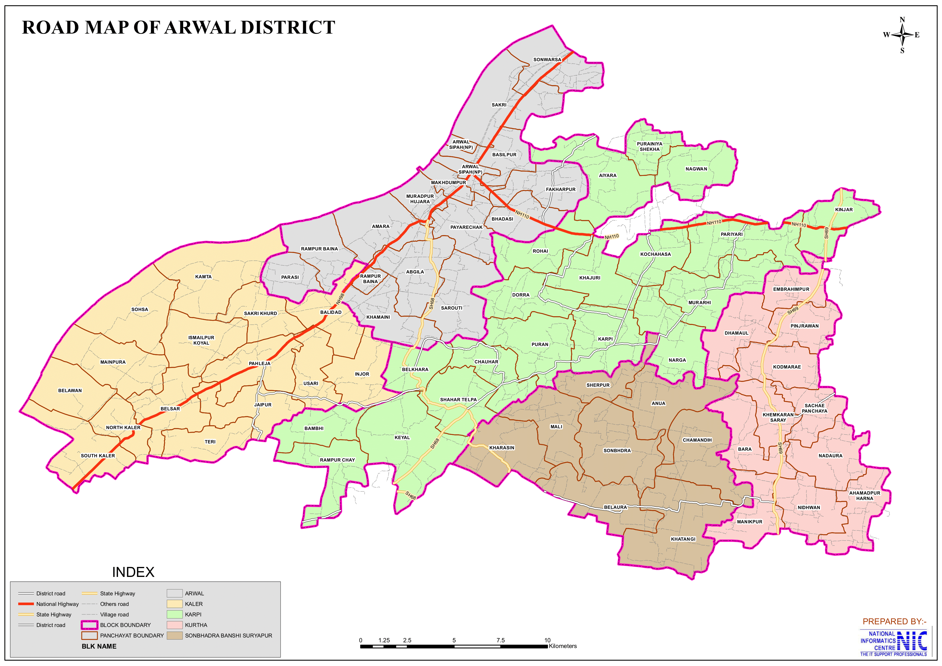
- Major Highways: NH-98
- Official Website: arwal.nic.in
Geography
- Location: Arwal is located in the southwest region of Bihar, bordered by Patna to the north, Jehanabad to the east, Aurangabad to the south, and Bhojpur to the west.
- Area: The district spans an area of 638 square kilometers, making it one of the smallest districts in Bihar.
- Topography: The region is part of the Gangetic plains, characterized by fertile alluvial soil.
- Climate: Arwal experiences a subtropical climate with hot summers, a monsoon season from June to September, and cool winters.
- Rivers: The Son River, a major tributary of the Ganges, flows through the district, playing a significant role in irrigation and agriculture.
History
- Arwal was historically part of the Magadha region, associated with ancient dynasties like the Mauryas and Guptas.
- The area played a role in the Indian independence movement, with notable participation from local leaders.
- Arwal was carved out of Jehanabad district on August 20, 2001, to facilitate better administrative governance.
Demographics (As per the 2011 Census)
- Population:
- Total Population: Arwal district has a population of approximately 700,843.
- Ranking: 502nd in India (out of 640 districts).
- Density: 1,099 persons per square kilometer (2,850/sq mi).
- Population Growth (2001–2011): 19.01% reflecting significant population increase.
- Sex Ratio: 927 females per 1,000 males, indicating a gender disparity.
- Literacy Rate: The literacy rate is 69.54%, reflecting progress in education but with significant efforts being made to improve education access and quality.
- Urban Population: 7.40% of the total population lives in urban areas.
- Religious Composition (2011 Census):
- Hinduism: 90.48%
- Scheduled Castes: 20.16%
- Scheduled Tribes: 0.08%
- Islam: 9.17%
- Other or not stated: 0.35%
- Languages: The primary languages spoken are Hindi, Magahi, and Urdu.
- Magahi: 86.53%
- Hindi: 8.11%
- Urdu: 4.96%
- Others: 0.40%
Administration
- Headquarters: The district headquarters is located in Arwal town.
- Subdivisions:
- Arwal has a single subdivision: Arwal Sadar.
- Each subdivision is led by a subdivisional magistrate who is in charge of development, revenue-related tasks, and maintaining law and order.
- Blocks and Circles:
- Arwal district comprises 5 administrative Blocks and Circles such as Arwal, Kaler, Karpi, Kurtha and Sonbhadra Banshi Suryapur, each responsible for local governance and development.
- A Circle officer (CO) leads each circle, while a Block Development Officer (BDO) leads each block.
- Governance: Arwal falls under the Magadh division and is part of the Jahanabad Lok Sabha constituency.
Organization Chart

Economy
The economy of Arwal district is predominantly agriculture-based. Despite the region being well-irrigated, farmers face challenges due to a lack of infrastructure and power supply, which limits their ability to maximize agricultural productivity.
- Agriculture:
- Agriculture is the primary occupation, with crops like paddy, wheat, pulses, and maize being widely cultivated.
- The fertile plains and irrigation facilities provided by the Son River contribute to good agricultural productivity.
- Industries:
- The district has limited industrial development, with small-scale agro-based industries and cottage industries like pottery and weaving.
- Challenges:
- Dependence on agriculture and lack of large-scale industries limit economic growth.
- The district currently lacks the presence of any major industries. However, agriculture-related industries are beginning to emerge, showing potential for future economic growth and development in the region.
Arwal’s economy remains heavily reliant on agriculture, and improvements in infrastructure and power availability could significantly benefit the livelihoods of the district’s farmers.
Education
- Institutions:
- Arwal has several government and private schools, catering to primary and secondary education.
- Colleges affiliated with Magadh University offer higher education in the district.
- Some Colleges:
- RCS College, Kurtha, Arwal
- S.J.S College, Kurtha, Arwal
- Fatehpur Sanda College, NH-98, Main Road, Arwal
- S.S.S Godani Singh College, NH-110, Arwal jehanabad Road
- Some Schools:
- High School, Kurtha, Arwal
- RCS College, Kurtha, Arwal
- High School Umairabad, Arwal
- Girls High School, Near Arwal Block, Arwal
- G.A Girls High School, NH-98, Main Road, Arwal
- Challenges:
- The district faces issues like inadequate infrastructure and a shortage of teachers, particularly in rural areas.
- Skill Development:
- Vocational training programs are being introduced to enhance employability among the youth.
Culture
- Festivals:
- Arwal celebrates major festivals like Chhath Puja, Diwali, Holi, Durga Puja, and Eid with fervor.
- Cuisine:
- Traditional dishes like litti chokha, sattu paratha, thekua, and pitha are popular in the district.
- Folk Traditions:
- Folk music, dance, and storytelling reflect the cultural heritage of the district.
Tourism
While Arwal is not a prominent tourist destination, it has some places of historical and religious importance:
- Son River:
- The river serves as a scenic spot and a lifeline for the district’s agriculture.
- Local Temples:
- There are small temples and religious sites frequented by locals during festivals and special occasions.
- Historical Connections:
- Nearby regions like Jehanabad and Aurangabad have sites of historical and archaeological importance, which also attract visitors to the area.
Transportation
- Roadways:
- Arwal is connected by a network of roads, with National Highway NH-139 passing through the district, linking it to Patna and other major cities.
- Local bus services and private vehicles are common modes of transport.
- Railways:
- The district does not have a major railway station, and the nearest railhead is in Jehanabad, approximately 35 km away.
- Airways:
- The nearest airport is Patna Airport, located about 80 km from the district headquarters.
Challenges
- Economic Development: Limited industrialization and overdependence on agriculture hinder the district’s economic growth.
- Infrastructure: Poor road connectivity, inadequate healthcare facilities, and lack of higher educational institutions are pressing issues.
- Flooding: The district is prone to seasonal flooding due to the overflow of the Son River, affecting agriculture and livelihoods.
Conclusion
Arwal is a district with immense potential due to its fertile lands and historical significance. Despite being one of the smallest districts in Bihar, it plays a crucial role in the socio-economic fabric of the state. However, addressing challenges like infrastructure development, industrial growth, and improved education can help unlock the district’s full potential and pave the way for its sustainable development. With its strategic location and hardworking population, Arwal has the potential to emerge as a model of balanced growth in Bihar.
Would you like more details about any specific Topics on Bihar? Comment Below or Checkout these topics

अरवल जिला: क्षेत्र के विशेष महत्व को जानें
अवलोकन
अरवल जिला भारत के बिहार राज्य के दक्षिण-पश्चिमी क्षेत्र में स्थित 38-जिलों में से एक है। शेखपुरा और शिवहर के बाद, यह 2001 तक बिहार में तीसरा सबसे कम आबादी वाला जिला (38 में से) है। 638 वर्ग किलोमीटर (246 वर्ग मील) के क्षेत्र में फैला, अरवल 25.164 डिग्री उत्तरी अक्षांश और 84.6688 डिग्री पूर्वी देशांतर पर स्थित है, और उत्तर में पटना जिले, पूर्व में जहानाबाद जिले, दक्षिण में औरंगाबाद जिले और पश्चिम में भोजपुर जिले के साथ सीमा साझा करता है। जिले का प्रशासनिक केंद्र अरवल शहर में स्थित है, और यह मगध डिवीजन के अंतर्गत आता है।
यह जिला सोन नदी के दाहिने किनारे पर स्थित है, जो गंगा नदी की एक सहायक नदी है, जो अपने ऐतिहासिक संबंधों और कृषि आधार के लिए जानी जाती है। 20 अगस्त 2001 को स्थापित, यह जहानाबाद जिले से अलग किया गया एक अपेक्षाकृत नया जिला है। अपने छोटे आकार के बावजूद, अरवल राज्य के सामाजिक-राजनीतिक परिदृश्य में अपने योगदान के लिए महत्वपूर्ण है।
लक्ष्मणपुर बाथे नरसंहार
जहानाबाद ने सामाजिक और राजनीतिक अशांति के प्रकरणों सहित महत्वपूर्ण ऐतिहासिक घटनाओं को देखा है। सबसे उल्लेखनीय और दुखद घटनाओं में से एक 1997 का लक्ष्मणपुर बाथे नरसंहार था। इस घटना में, प्रमुख भूमिहार जाति के एक निजी मिलिशिया रणवीर सेना ने दलित ग्रामीणों को निशाना बनाया और उन पर नक्सली समर्थक होने का आरोप लगाते हुए उनकी हत्या कर दी।
यह नरसंहार भूमि विवाद और जाति-आधारित तनाव में निहित एक बड़े संघर्ष का हिस्सा था। दलित, जो अक्सर नक्सली कैडर से जुड़े होते थे, उच्च जाति के व्यक्तियों के स्वामित्व वाली भूमि पर कब्जा करने में शामिल थे। इसके कारण रणवीर सेना द्वारा हिंसक प्रतिशोध हुआ, जिसका उद्देश्य जाति का वर्चस्व बनाए रखना और नक्सलियों के बढ़ते प्रभाव का मुकाबला करना था।
लक्ष्मणपुर बाथे में हुई हिंसा पहले हुए नरसंहारों, जैसे बारा नरसंहार और सेनारी नरसंहार की प्रतिक्रिया थी, जहाँ मुख्य रूप से दलित सदस्यों से बने नक्सलियों ने भूमिहारों सहित उच्च जाति के लोगों की हत्या की थी। हिंसा के इस चक्र ने जहानाबाद को लाल गलियारे के केंद्र में ला खड़ा किया, जो माओवादी विद्रोह और सामाजिक संघर्ष से चिह्नित क्षेत्र है।
जहानाबाद के इतिहास का यह काला अध्याय उन गहरी सामाजिक असमानताओं और तनावों को रेखांकित करता है, जिन्होंने इस क्षेत्र के अतीत को आकार दिया है।
अरवल जिले का जल विज्ञान
अरवल अपनी उत्कृष्ट जल गुणवत्ता और उच्च उपलब्धता के लिए बिहार के जिलों में सबसे अलग है। विशेषज्ञ सर्वेक्षणों के अनुसार:
- पानी उथली गहराई पर उपलब्ध है, जिससे अधिकांश घरों में मोटर चालित प्रणालियों या भंडारण टैंकों के बजाय हैंडपंप का उपयोग करने की अनुमति मिलती है।
- अरवल में भूमिगत जल पूरी तरह से अशुद्धियों से मुक्त है, जो इसे इस क्षेत्र की एक अनूठी विशेषता बनाता है।
सोन नदी, जो जिले से होकर बहती है, अपने प्रचुर जल संसाधनों के साथ, कृषि और संभावित औद्योगिक विकास दोनों के लिए अनुकूल परिस्थितियाँ बनाती है।
अरवल गंगा के मैदान का हिस्सा है, जिसकी विशेषता उपजाऊ कृषि क्षेत्र हैं जो विभिन्न फसलों की खेती का समर्थन करते हैं। अच्छी परिवहन सुविधाओं, पानी की उपलब्धता और उपजाऊ भूमि का संयोजन अरवल को कृषि उत्पादकता और भविष्य के औद्योगिक विकास के लिए एक आशाजनक जिला बनाता है।
अरवल जिले के बारे में मुख्य तथ्य
- देश: भारत
- राज्य: बिहार
- प्रमंडल: मगध
- स्थापना: 20 अगस्त 2001
- निर्देशांक: 25°14′24″N 84°40′12″E
- क्षेत्रफल: 638 km2 (246 sq mi)
- जनसंख्या (2011):
- कुल: 700,843
- घनत्व: 1,100/km2 (2,800/sq mi)
- साक्षरता दर: 69.54%
- लिंग अनुपात: 928/1000
- जिला मुख्यालय: अरवल
- ग्राम पंचायत: 65
- गांव: 335
- अनुमंडल की संख्या: 1 (अरवल सदर)
- ब्लॉक की संख्या: 5 (अरवल, कलेर, करपी, कुर्था, सोनभद्र बंशी सूर्यपुर)
- पुलिस स्टेशन: 11
- अरवल, रामपुर चौरम, परासी, मेहंदिया, कलेर, करपी, कुर्था, किंजर, बंशी ओपी, मानिकपुर ओपी, शहरतेलपा ओपी
- नगर परिषद: 1 (जहानाबाद)
- नगर पंचायत: 1 (कुर्था)
- लोकसभा क्षेत्र: 1 (जहानाबाद)
- विधान सभा क्षेत्र: 2 (अरवल और कुर्था)
- प्रमुख विशेषताऐं:
- संभाग का सबसे छोटा जिला, मुख्यतः कृषि प्रधान।
- बिहार की ग्रामीण अर्थव्यवस्था में योगदान के लिए जाना जाता है।
- मगध की समृद्ध परंपराओं से सांस्कृतिक रूप से जुड़ा हुआ।
- महत्व: कृषि और ग्रामीण विकास पर ध्यान केंद्रित।
- समय क्षेत्र: UTC+05:30 (IST)
- पिन कोड: 8543XX
- प्रमुख राजमार्ग: NH-98
- आधिकारिक वेबसाइट: arwal.nic.in
भूगोल
- स्थान: अरवल बिहार के दक्षिण-पश्चिम क्षेत्र में स्थित है, जिसकी सीमा उत्तर में पटना, पूर्व में जहानाबाद, दक्षिण में औरंगाबाद और पश्चिम में भोजपुर से लगती है।
- क्षेत्र: यह जिला 638 वर्ग किलोमीटर में फैला हुआ है, जो इसे बिहार के सबसे छोटे जिलों में से एक बनाता है।
- स्थलाकृति: यह क्षेत्र गंगा के मैदानों का हिस्सा है, जिसकी विशेषता उपजाऊ जलोढ़ मिट्टी है।
- जलवायु: अरवल में गर्म ग्रीष्मकाल, जून से सितंबर तक मानसून का मौसम और ठंडी सर्दियाँ के साथ उपोष्णकटिबंधीय जलवायु होती है।
- नदियाँ: गंगा की एक प्रमुख सहायक नदी सोन नदी जिले से होकर बहती है, जो सिंचाई और कृषि में महत्वपूर्ण भूमिका निभाती है।
इतिहास
- अरवल ऐतिहासिक रूप से मगध क्षेत्र का हिस्सा था, जो मौर्य और गुप्त जैसे प्राचीन राजवंशों से जुड़ा था।
- इस क्षेत्र ने भारतीय स्वतंत्रता आंदोलन में महत्वपूर्ण भूमिका निभाई, जिसमें स्थानीय नेताओं की उल्लेखनीय भागीदारी थी।
- बेहतर प्रशासनिक शासन की सुविधा के लिए 20 अगस्त, 2001 को जहानाबाद जिले से अरवल को अलग किया गया था।
जनसांख्यिकी (2011 की जनगणना के अनुसार)
- जनसंख्या:
- कुल जनसंख्या: अरवल जिले की जनसंख्या लगभग 700,843 है।
- रैंकिंग: भारत में 502वाँ स्थान (640 जिलों में से)।
- घनत्व: 1,099 व्यक्ति प्रति वर्ग किलोमीटर (2,850/वर्ग मील)।
- जनसंख्या वृद्धि (2001-2011): 19.01%, जो महत्वपूर्ण जनसंख्या वृद्धि को दर्शाता है।
- लिंग अनुपात: प्रति 1,000 पुरुषों पर 927 महिलाएँ, जो लैंगिक असमानता को दर्शाता है।
- साक्षरता दर: साक्षरता दर 69.54% है, जो शिक्षा में प्रगति को दर्शाती है, लेकिन शिक्षा की पहुँच और गुणवत्ता में सुधार के लिए महत्वपूर्ण प्रयास किए जा रहे हैं।
- शहरी जनसंख्या: कुल जनसंख्या का 7.40% शहरी क्षेत्रों में रहता है।
- धार्मिक संरचना (2011 की जनगणना):
- हिंदू धर्म: 90.48%
- अनुसूचित जाति: 20.16%
- अनुसूचित जनजाति: 0.08%
- इस्लाम: 9.17%
- अन्य या नहीं बताया गया: 0.35%
- हिंदू धर्म: 90.48%
- भाषाएँ: बोली जाने वाली मुख्य भाषाएँ हिंदी, मगही और उर्दू हैं।
- मगही: 86.53%
- हिंदी: 8.11%
- उर्दू: 4.96%
- अन्य: 0.40%
प्रशासन
- मुख्यालय: जिला मुख्यालय अरवल शहर में स्थित है।
- उपखंड:
- अरवल में एक ही उपखंड है: अरवल सदर।
- प्रत्येक उपखंड का नेतृत्व एक उपखंड मजिस्ट्रेट करता है जो विकास, राजस्व संबंधी कार्यों और कानून व्यवस्था बनाए रखने का प्रभारी होता है।
- ब्लॉक और सर्किल:
- अरवल जिले में 5 प्रशासनिक ब्लॉक और सर्किल शामिल हैं जैसे अरवल, कलेर, करपी, कुर्था और सोनभद्र बंशी सूर्यपुर, जिनमें से प्रत्येक स्थानीय शासन और विकास के लिए जिम्मेदार है।
- प्रत्येक सर्किल का नेतृत्व एक सर्किल अधिकारी (सीओ) करता है, जबकि प्रत्येक ब्लॉक का नेतृत्व एक ब्लॉक विकास अधिकारी (बीडीओ) करता है।
- शासन: अरवल मगध डिवीजन के अंतर्गत आता है और जहानाबाद लोकसभा निर्वाचन क्षेत्र का हिस्सा है।
अर्थव्यवस्था
अरवल जिले की अर्थव्यवस्था मुख्य रूप से कृषि आधारित है। क्षेत्र में अच्छी सिंचाई व्यवस्था होने के बावजूद, किसानों को बुनियादी ढांचे और बिजली आपूर्ति की कमी के कारण चुनौतियों का सामना करना पड़ता है, जो कृषि उत्पादकता को अधिकतम करने की उनकी क्षमता को सीमित करता है।
- कृषि:
- कृषि प्राथमिक व्यवसाय है, जिसमें धान, गेहूं, दालें और मक्का जैसी फसलें व्यापक रूप से उगाई जाती हैं।
- सोन नदी द्वारा प्रदान की जाने वाली उपजाऊ मैदान और सिंचाई सुविधाएँ अच्छी कृषि उत्पादकता में योगदान करती हैं।
- उद्योग:
- जिले में औद्योगिक विकास सीमित है, जिसमें छोटे पैमाने के कृषि आधारित उद्योग और मिट्टी के बर्तन और बुनाई जैसे कुटीर उद्योग शामिल हैं।
- चुनौतियाँ:
- कृषि पर निर्भरता और बड़े पैमाने के उद्योगों की कमी आर्थिक विकास को सीमित करती है।
- जिले में वर्तमान में किसी भी प्रमुख उद्योग की उपस्थिति का अभाव है। हालाँकि, कृषि से संबंधित उद्योग उभरने लगे हैं, जो क्षेत्र में भविष्य के आर्थिक विकास और विकास की संभावना दिखाते हैं।
अरवल की अर्थव्यवस्था कृषि पर बहुत अधिक निर्भर है, और बुनियादी ढाँचे और बिजली की उपलब्धता में सुधार से जिले के किसानों की आजीविका को काफी लाभ हो सकता है।
शिक्षा
- संस्थाएँ:
- अरवल में कई सरकारी और निजी स्कूल हैं, जो प्राथमिक और माध्यमिक शिक्षा प्रदान करते हैं।
- मगध विश्वविद्यालय से संबद्ध कॉलेज जिले में उच्च शिक्षा प्रदान करते हैं।
- कुछ कॉलेज:
- आरसीएस कॉलेज, कुर्था, अरवल
- एस.जे.एस कॉलेज, कुर्था, अरवल
- फतेहपुर सांडा कॉलेज, एनएच-98, मेन रोड, अरवल
- एस.एस.एस गोदानी सिंह कॉलेज, एनएच-110, अरवल जहानाबाद रोड
- कुछ स्कूल:
- हाई स्कूल, कुर्था, अरवल
- आरसीएस कॉलेज, कुर्था, अरवल
- हाई स्कूल उमैराबाद, अरवल
- गर्ल्स हाई स्कूल, अरवल ब्लॉक के पास, अरवल
- जी.ए गर्ल्स हाई स्कूल, एनएच-98, मेन रोड, अरवल
- चुनौतियाँ:
- जिले में अपर्याप्त बुनियादी ढाँचे और शिक्षकों की कमी जैसी समस्याएँ हैं, खासकर ग्रामीण इलाकों में।
- कौशल विकास:
- युवाओं में रोज़गार की संभावना बढ़ाने के लिए व्यावसायिक प्रशिक्षण कार्यक्रम शुरू किए जा रहे हैं।
संस्कृति
- त्यौहार:
- अरवल में छठ पूजा, दिवाली, होली, दुर्गा पूजा और ईद जैसे प्रमुख त्यौहार धूमधाम से मनाए जाते हैं।
- व्यंजन:
- लिट्टी चोखा, सत्तू पराठा, ठेकुआ और पीठा जैसे पारंपरिक व्यंजन जिले में लोकप्रिय हैं।
- लोक परंपराएँ:
- लोक संगीत, नृत्य और कहानी सुनाना जिले की सांस्कृतिक विरासत को दर्शाता है।
पर्यटन
हालाँकि अरवल एक प्रमुख पर्यटन स्थल नहीं है, लेकिन यहाँ ऐतिहासिक और धार्मिक महत्व के कुछ स्थान हैं:
- सोन नदी:
- यह नदी एक दर्शनीय स्थल और जिले की कृषि के लिए जीवन रेखा का काम करती है।
- स्थानीय मंदिर:
- यहाँ छोटे मंदिर और धार्मिक स्थल हैं जहाँ स्थानीय लोग त्योहारों और विशेष अवसरों पर आते हैं।
- ऐतिहासिक संबंध:
- जहानाबाद और औरंगाबाद जैसे आस-पास के क्षेत्रों में ऐतिहासिक और पुरातात्विक महत्व के स्थल हैं, जो क्षेत्र में आगंतुकों को भी आकर्षित करते हैं।
परिवहन
- सड़क मार्ग:
- अरवल सड़कों के एक नेटवर्क से जुड़ा हुआ है, जिसमें राष्ट्रीय राजमार्ग NH-139 जिले से होकर गुजरता है, जो इसे पटना और अन्य प्रमुख शहरों से जोड़ता है।
- स्थानीय बस सेवाएँ और निजी वाहन परिवहन के सामान्य साधन हैं।
- रेलवे:
- जिले में कोई बड़ा रेलवे स्टेशन नहीं है, और निकटतम रेलवे स्टेशन जहानाबाद में है, जो लगभग 35 किमी दूर है।
- वायुमार्ग:
- निकटतम हवाई अड्डा पटना हवाई अड्डा है, जो जिला मुख्यालय से लगभग 80 किमी दूर स्थित है।
चुनौतियाँ
- आर्थिक विकास: सीमित औद्योगिकीकरण और कृषि पर अत्यधिक निर्भरता जिले के आर्थिक विकास में बाधा डालती है।
- बुनियादी ढाँचा: खराब सड़क संपर्क, अपर्याप्त स्वास्थ्य सुविधाएँ और उच्च शिक्षण संस्थानों की कमी दबावपूर्ण मुद्दे हैं।
- बाढ़: सोन नदी के उफान के कारण जिले में मौसमी बाढ़ का खतरा बना रहता है, जिससे कृषि और आजीविका प्रभावित होती है।
निष्कर्ष
अरवल अपनी उपजाऊ भूमि और ऐतिहासिक महत्व के कारण अपार संभावनाओं वाला जिला है। बिहार के सबसे छोटे जिलों में से एक होने के बावजूद, यह राज्य के सामाजिक-आर्थिक ताने-बाने में महत्वपूर्ण भूमिका निभाता है। हालाँकि, बुनियादी ढाँचे के विकास, औद्योगिक विकास और बेहतर शिक्षा जैसी चुनौतियों का समाधान करने से जिले की पूरी क्षमता को अनलॉक करने और इसके सतत विकास का मार्ग प्रशस्त करने में मदद मिल सकती है। अपने रणनीतिक स्थान और मेहनती आबादी के साथ, अरवल में बिहार में संतुलित विकास के मॉडल के रूप में उभरने की क्षमता है।
क्या आप बिहार के किसी विशेष विषय के बारे में अधिक जानकारी चाहते हैं? नीचे टिप्पणी करें 😊
पदानुक्रमिक संरचना: बिहार का विस्तृत रोडमैप
बिहार में प्रमंडल और उसके जिलों का विवरण
Importanat Links
𝕋𝕙𝕒𝕟𝕜 𝕐𝕠𝕦 𝔽𝕠𝕣 𝕍𝕚𝕤𝕚𝕥𝕚𝕟𝕘 𝕆𝕦𝕣 𝕎𝕖𝕓𝕤𝕚𝕥𝕖𝕤 🙂
4 thoughts on “Arwal District: Explore the Special Significance of Region”